Rhine Cycle Route: EuroVelo 15 From the Alps to the North Sea
The Rhine Cycle Route in seven parts, from the Oberalp Pass to the Hook of Holland: distances, surfaces, which bank to ride and the best week for a first trip.
Quick links
Don't want to read all this?
We've planned 800+ cycling trips. Send your dates, fitness and group size — we'll map the route and book every night.


The Rhine Cycle Route follows one river through six countries, from a small lake below the Oberalp Pass to the North Sea. You cross covered wooden bridges between Switzerland and Germany, ride the canal towpath through Alsace into Strasbourg and pass below the castles and terraced vineyards of the Rhine Gorge.
The route is EuroVelo 15, about 1,230 km from Andermatt to the Hook of Holland. Its first 250 km are an Alpine descent with gravel and real climbs, but from Lake Constance to the sea the route is almost flat.
France has about 180 km of it, on the Alsace bank between Basel and Lauterbourg. Our guide to cycling in France covers the country's other long routes.
How Long Is the Rhine Cycle Route?
Three lengths are in print, and each measures something different. The classic figure of about 1,230 km follows one bank from Andermatt to the Hook of Holland. Cicerone's guidebook starts higher, at the 2,046 m Oberalp Pass, and counts 1,368 km in 27 stages.
EuroVelo now quotes 1,450 km. Its total counts the variants on both banks, which run side by side for long stretches, and the 62 km added in 2025 between Trübbach and Lustenau. That extension brought Liechtenstein and Austria onto the route, which now crosses six countries.
How Many Days Do You Need?
Time depends on your daily distance. Cicerone's Rhine Cycle Route stages average just over 50 km, so the whole river takes about four weeks at one stage a day. Two to three weeks means 65 to 100 km a day.
Pace | Daily distance | Riding days for 1,368 km |
One Cicerone stage a day | about 50 km | 27 |
Steady touring | 65 to 70 km | 20 to 21 |
Long days | about 100 km | 14 |
Add a rest day a week for the cities. Most riders choose one or two parts and ride them in a week, with a train at each end.
The Rhine Cycle Route Stage by Stage
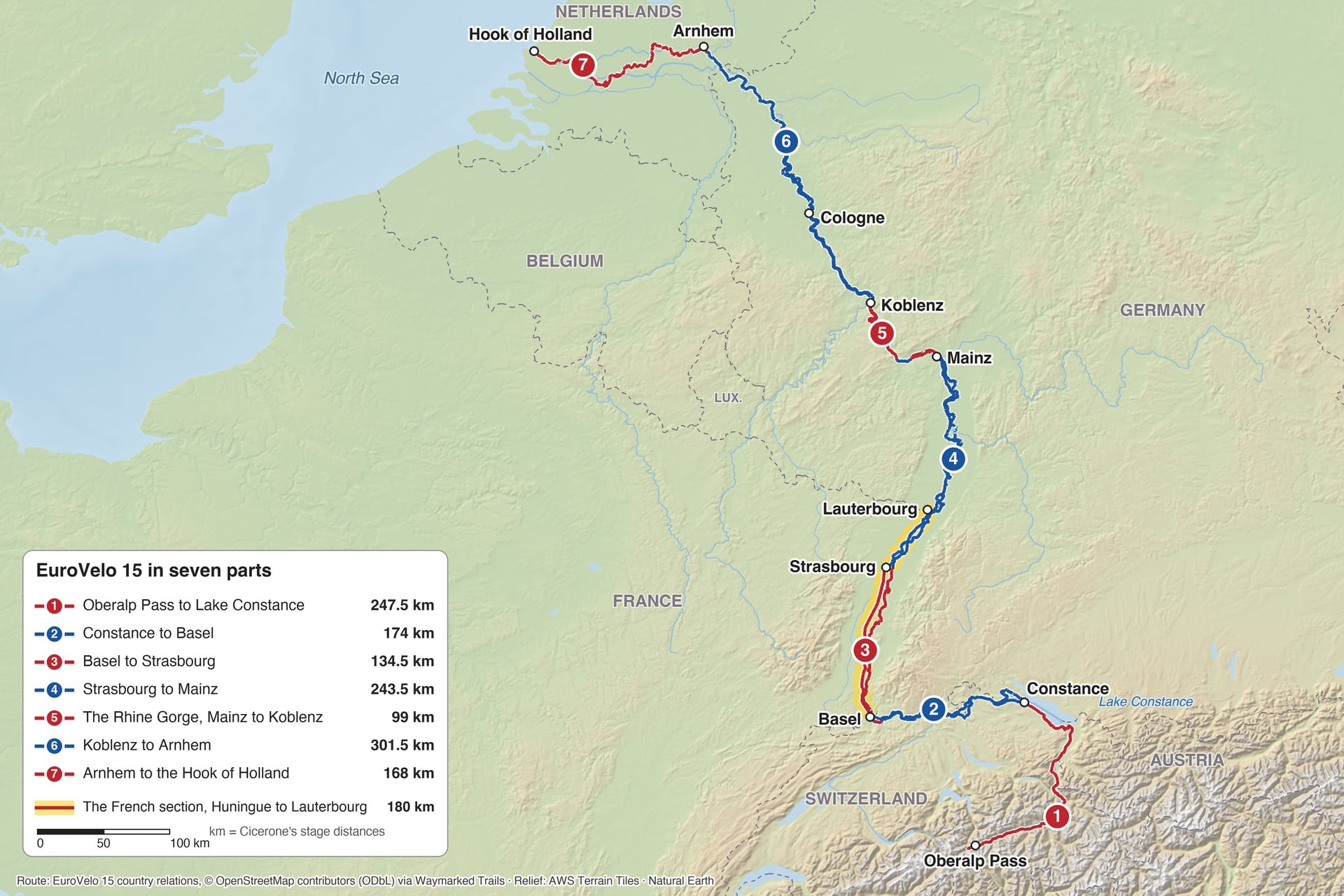
The landscape changes every few days, from an Alpine gorge and the shore of Lake Constance to cathedral cities, a castle-lined gorge and the dykes of the Netherlands. Most riders go downstream, from 2,046 m at the Oberalp Pass to sea level over 1,368 km, and long stretches have a signed route on both banks.
Section | Distance | Cicerone stages | On the way |
Oberalp Pass to Constance | 247.5 km | 1 to 5 | Alpine descent, Chur, the shore of Lake Constance |
Constance to Basel | 174 km | 6 to 8 | Stein am Rhein, the Rhine Falls, covered bridges |
Basel to Strasbourg | 134.5 km | 9 and 10 | Canal towpath, Neuf-Brisach, Strasbourg |
Strasbourg to Mainz | 243.5 km | 11 to 15 | Flood dykes, Speyer, Worms |
Mainz to Koblenz | 99 km | 16 and 17 | Castles and vineyards of the Rhine Gorge |
Koblenz to Arnhem | 301.5 km | 18 to 23 | Bonn, Cologne, Düsseldorf, Xanten |
Arnhem to the Hook of Holland | 168 km | 24 to 27 | Dyke paths, ferries, Kinderdijk, Rotterdam |
The distances are Cicerone's stage lengths, 1,368 km in all, and each town under Where to sleep is a stage end, with its distance from the start of that part. France's 180 km of signed route covers all of Part 3 and the first 72 km of Part 4, from Strasbourg to Lauterbourg.
Part 1: Oberalp Pass to Lake Constance
Distance: 247.5 km, Cicerone stages 1 to 5
Surface: paved roads and forest tracks, with gravel in places above Chur
Gradient: a 1,341 m drop to Ilanz in the first 52 km, then a steady descent to 402 m at Constance
Where to sleep: Ilanz 52 km, Chur 87 km, Buchs 135 km, Bregenz 189.5 km, Constance 247.5 km
Banks and crossings: one line through the Alps; since 2025, a right-bank variant through Vaduz and Austria
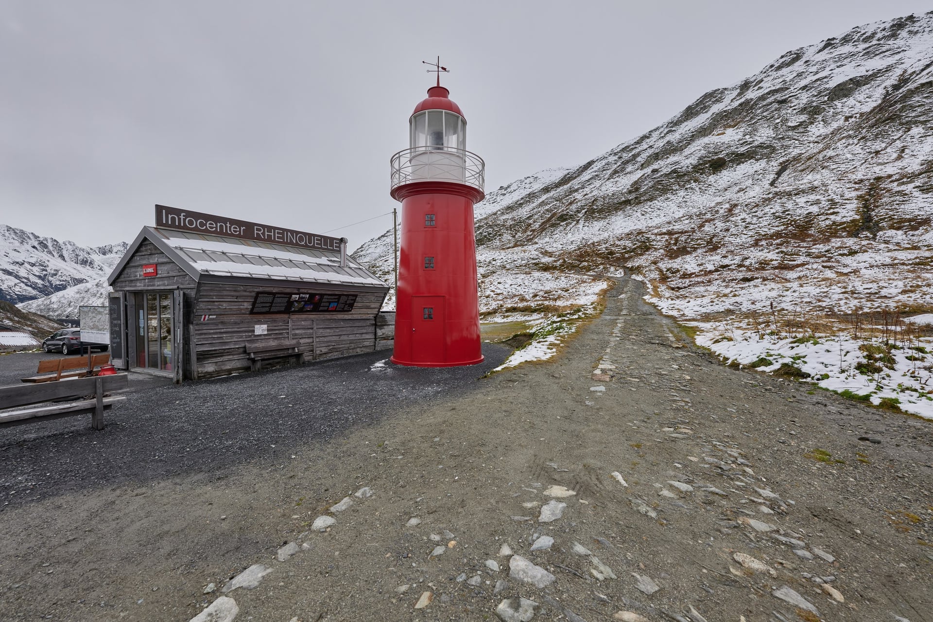
The source is a short walk above the pass, at Lai da Tuma (2,345 m), and the first stage drops hard to Ilanz. Between Andermatt and Breil/Brigels the road carries mixed and heavy traffic, and EuroVelo advises that stretch for experienced riders only.
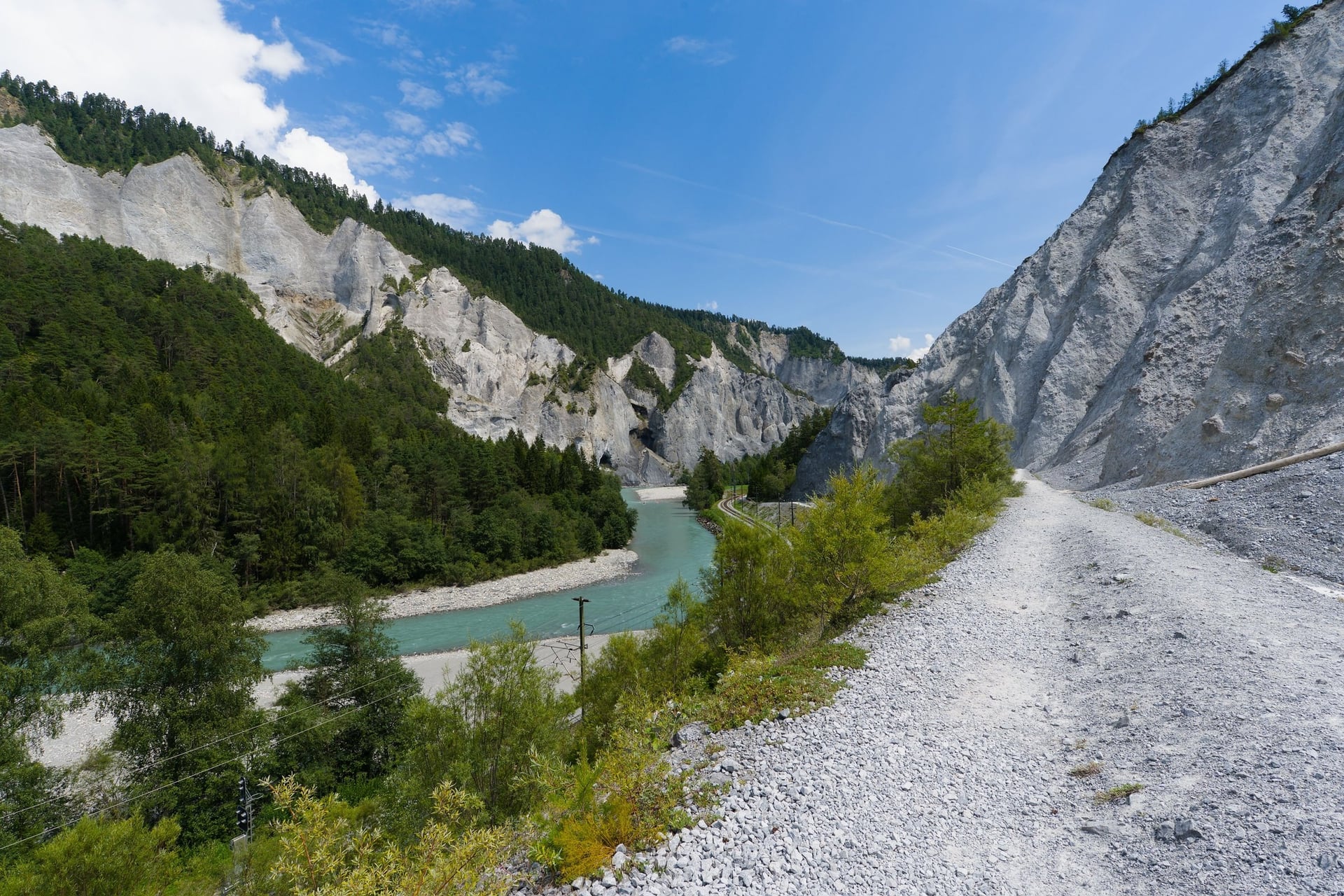
Below Ilanz the route runs above the Ruinaulta, a gorge with white cliffs, to Chur, Switzerland's oldest town, 87 km from the pass. The valley then widens past Liechtenstein, and the last 58 km follow the lake shore from Bregenz to Constance. The Oberalp road usually opens in late April or early May.
Part 2: Constance to Basel
Distance: 174 km, Cicerone stages 6 to 8
Surface: cycle paths and quiet roads, with short gravel stretches
Gradient: gently rolling, with short climbs over vineyard hills; 402 m at Constance, 263 m at Basel
Where to sleep: Schaffhausen 47 km, Waldshut 107.5 km, Basel 174 km
Banks and crossings: signed on the Swiss and German banks, with bridges at Rheinau, Bad Säckingen and Rheinfelden
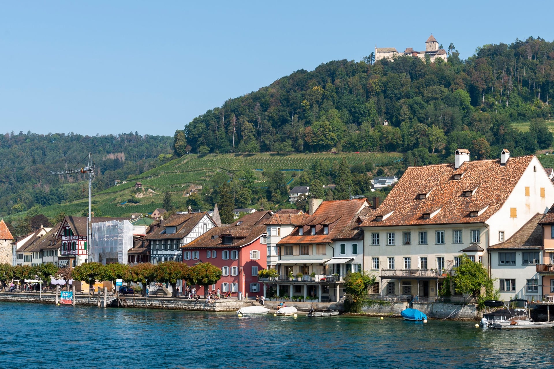
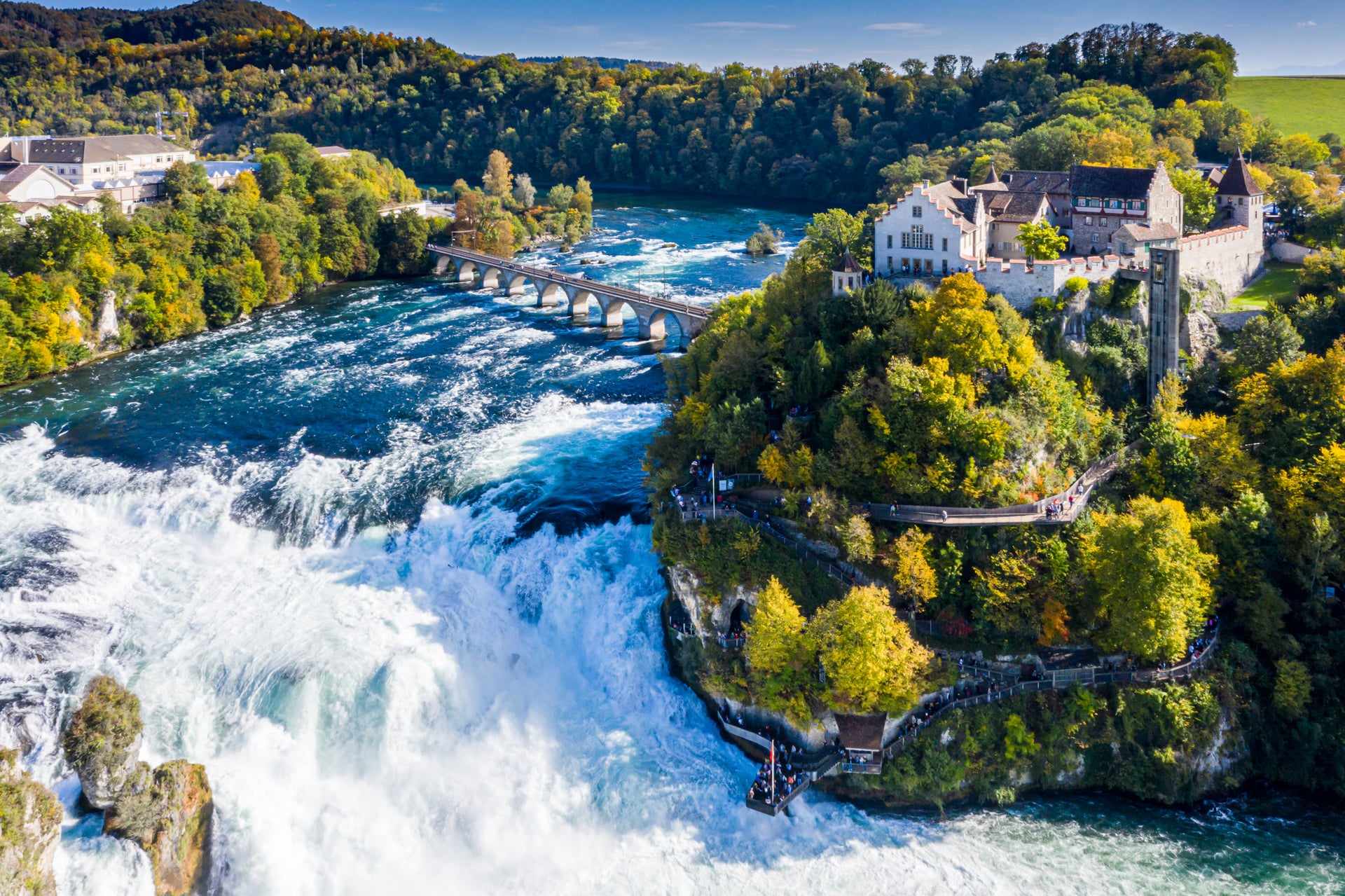
Leaving Constance, the route follows the Untersee shore to Stein am Rhein, a medieval town of painted houses, and reaches Schaffhausen after 47 km. Just downstream, the Rhine Falls drop 23 m over a width of 150 m, the largest waterfall in Europe.
Below the falls the route runs 127 km to Basel, with the river as the border for most of the way. Covered bridges cross it at Rheinau and Bad Säckingen, where the 204 m bridge is the longest of its kind in Europe. The German railway on this stretch is closed in 2026, so plan every day here as a full riding day.
Part 3: Basel to Strasbourg
Distance: 134.5 km, Cicerone stages 9 and 10; the French section runs 180 km from Huningue to Lauterbourg
Surface: towpath and cycle paths beside the Canal du Rhône au Rhin; 76% of the French section is cycle path
Gradient: flat; the whole French section gains only 33 m
Where to sleep: Neuf-Brisach 67 km, Strasbourg 134.5 km
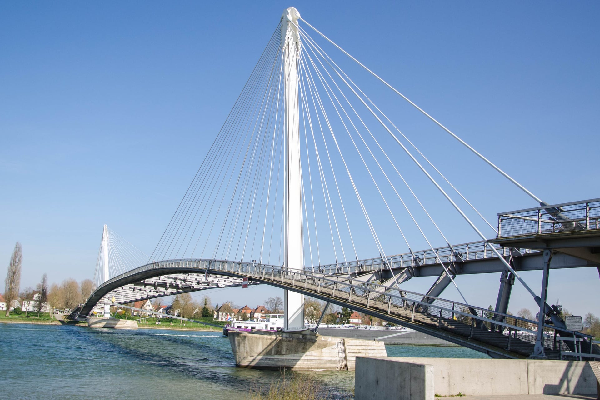
Banks and crossings: cycle bridges at Huningue, Chalampé and Strasbourg, and a free ferry at Rhinau
From Huningue, beside Basel, the French route follows the Canal du Rhône au Rhin past the Kembs-Niffer lock, whose buildings Le Corbusier designed, and Ottmarsheim's octagonal church. Neuf-Brisach, 67 km from Basel, ends the first day, and Vauban's fortress town is a UNESCO World Heritage Site.
About 20 locks break up the towpath on the 67.5 km from Neuf-Brisach to Strasbourg, where the city's 600 km of cycle routes form France's largest network. France Vélo Tourisme rates the French section a beginner route, and families can ride from Basel to Strasbourg safely.
Part 4: Strasbourg to Mainz
Distance: 243.5 km, Cicerone stages 11 to 15
Surface: dyke tops and paved paths, with some gravel and more shared small roads between Strasbourg and Lauterbourg
Gradient: flat, from 140 m at Strasbourg to 86 m at Mainz
Where to sleep: Drusenheim 33 km, Karlsruhe 89.5 km, Speyer 141 km, Worms 189.5 km, Mainz 243.5 km
Banks and crossings: the French bank to Lauterbourg with ferries at Drusenheim and Seltz, then signed routes on both German banks
North of Strasbourg the French route crosses forest on the flood barrier and passes the Gambsheim locks, with the largest fish pass in Europe, before Lauterbourg ends Alsace after 72 km. In Germany the path often follows flood dykes out of sight of the water, and riders on forums call this the plainest part.
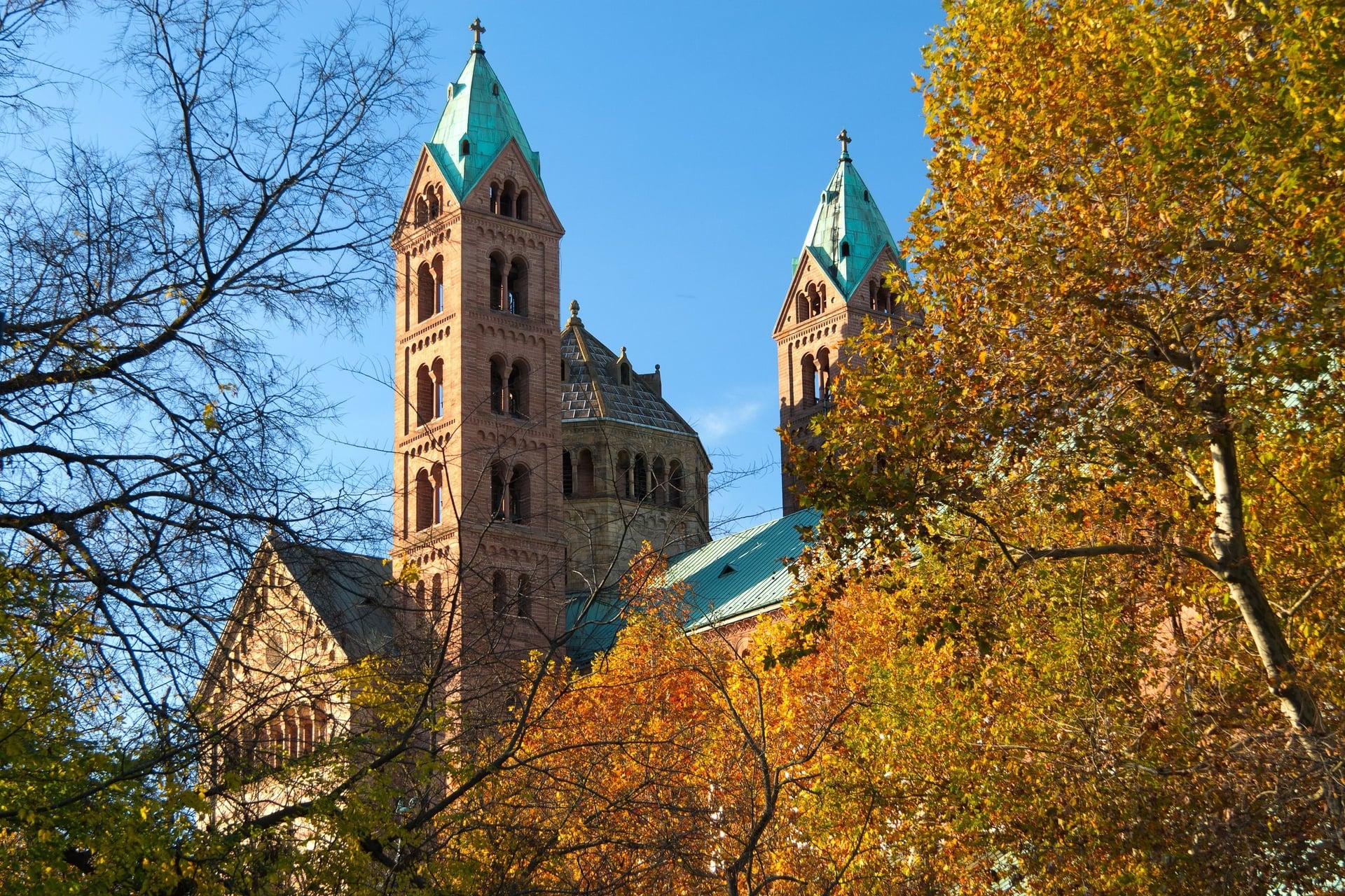
Speyer and Worms, 48.5 km apart, are the reasons to slow down: Speyer's cathedral was founded in 1030, and Worms is one of Germany's oldest cities. Mannheim, on the east bank, has one of Europe's largest Baroque palaces, and riders recommend the west bank from Germersheim for its smooth tarmac.
Part 5: The Rhine Gorge, Mainz to Koblenz
Distance: 99 km, Cicerone stages 16 and 17
Surface: riverside cycle paths, in places right beside the road and through town streets
Gradient: flat beside the river, below steep vineyard slopes
Where to sleep: Bacharach 49 km, Koblenz 99 km
Banks and crossings: the west bank is complete; the east bank has gaps between Kestert and St. Goarshausen
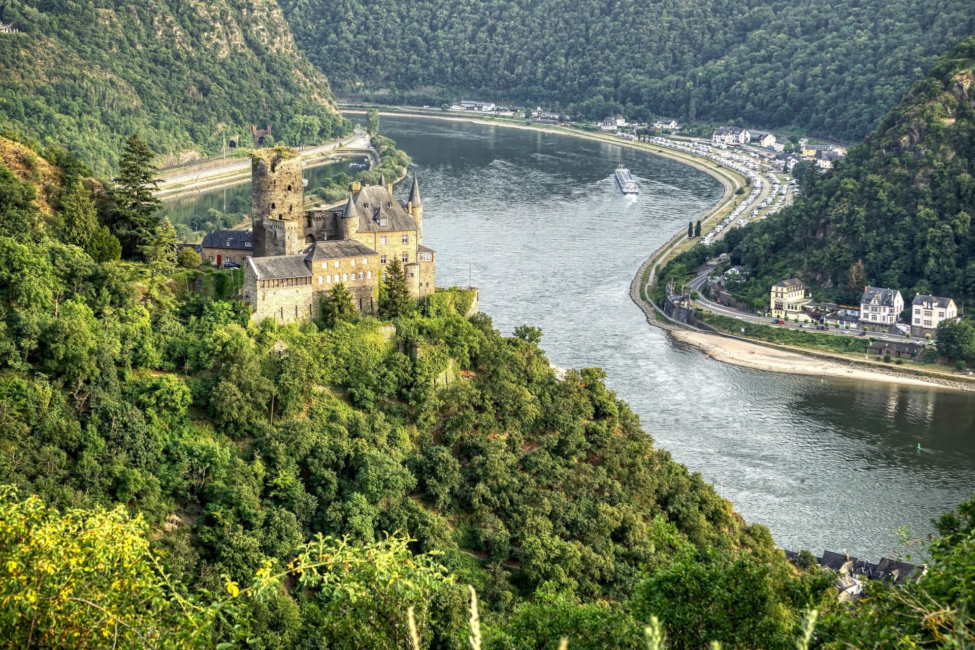
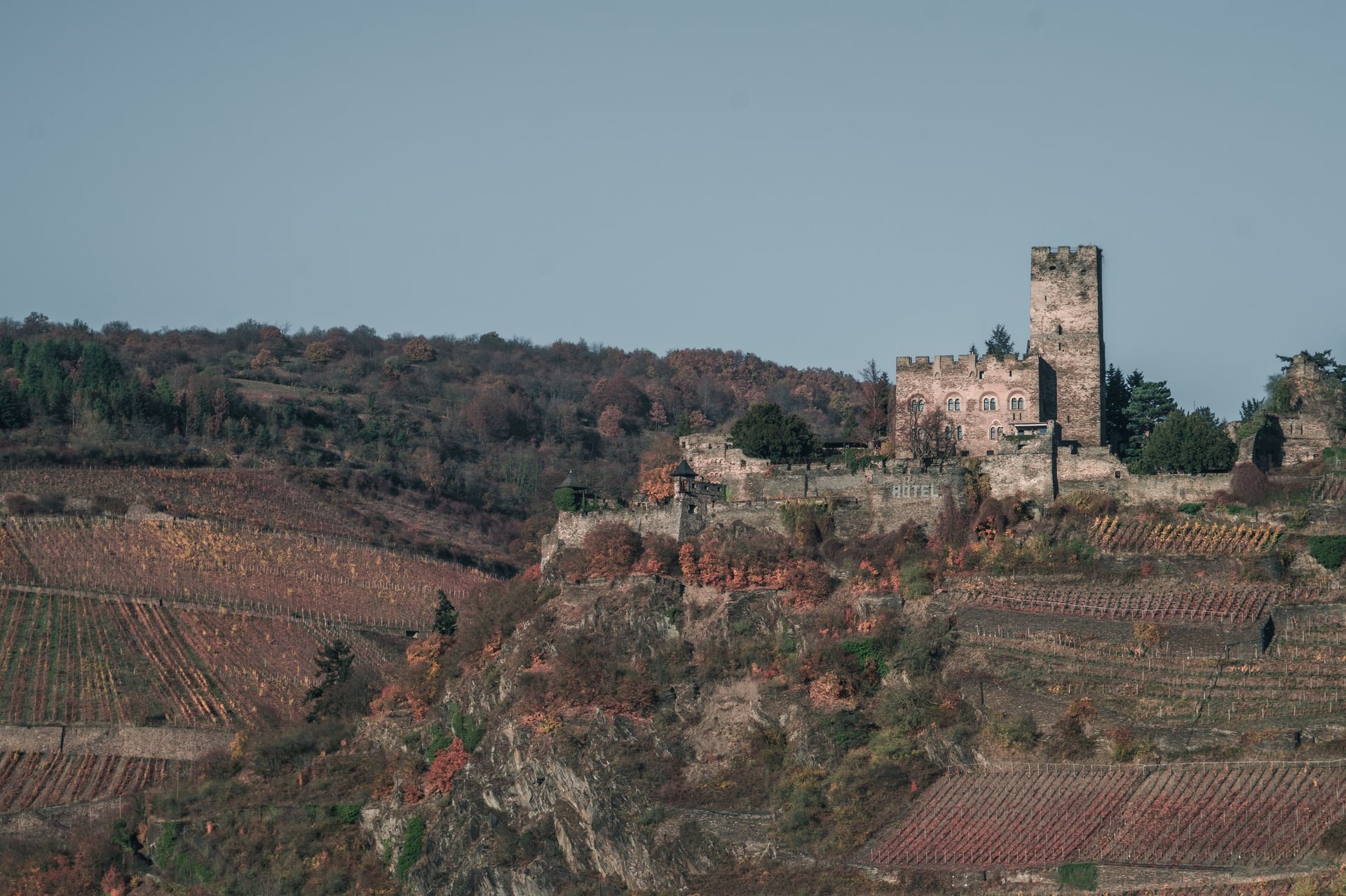
The 65 km from Bingen and Rüdesheim to Koblenz is the Upper Middle Rhine Valley, a UNESCO World Heritage Site for its castles and vineyards. Bacharach, 49 km from Mainz, makes a good halfway night, and the Loreley rock stands above St. Goarshausen.
The valley is narrow, so the path sometimes runs beside the road, and between Kestert and St. Goarshausen EuroVelo advises switching to the west bank or taking a boat. At Koblenz, after 99 km, the Moselle flows in at the Deutsches Eck; its French stretch, La Voie Bleue, is in our France guide.
Part 6: Koblenz to Arnhem
Distance: 301.5 km, Cicerone stages 18 to 23
Surface: wide paved paths and riverside promenades, with city streets in Cologne and Düsseldorf
Gradient: flat, from 65 m at Koblenz to 23 m at Arnhem
Where to sleep: Remagen 46 km, Cologne 103.5 km, Düsseldorf 155.5 km, Duisburg 187.5 km, Xanten 236 km, Arnhem 301.5 km
Banks and crossings: signed paths on both banks in places, with bridges in every city
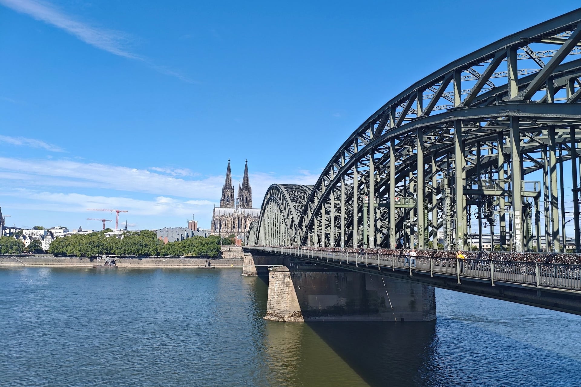
Cities set the pace here. Bonn has Beethoven's birthplace, and Cologne's cathedral, with its 157 m spires, stands beside the river. Düsseldorf follows, then Duisburg, where the Ruhr flows in and Europe's biggest river port lines the banks.
Some riders find the harbours dull, while others stop at the Landschaftspark Duisburg-Nord, a former ironworks turned into a park. Past Xanten, 236 km from Koblenz, the scenery turns to meadows and farmland, and the route crosses into the Netherlands near Emmerich.
Part 7: Arnhem to the Hook of Holland
Distance: 168 km, Cicerone stages 24 to 27
Surface: dyke-top paths and quiet roads, with several ferry crossings
Gradient: flat apart from the Veluwe foothills and the Utrechtse Heuvelrug, dipping to 2 m below sea level at Schoonhoven
Where to sleep: Wijk bij Duurstede 50.5 km, Schoonhoven 98.5 km, Rotterdam 135.5 km, Hook of Holland 168 km
Banks and crossings: small recreational ferries over the Nederrijn and the Lek, on seasonal timetables
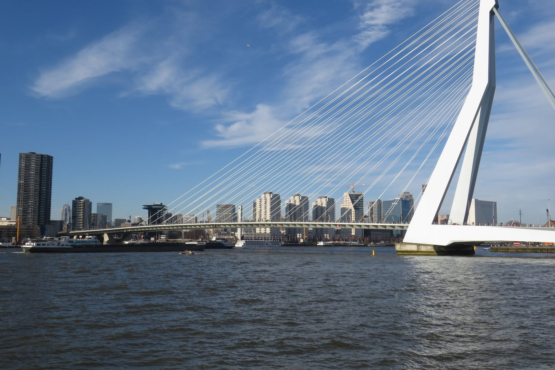
In the Netherlands the Rhine splits into several arms, and the route follows the Nederrijn and the Lek on quiet dyke paths. Even here you will need low gears in places: the Veluwe foothills and the Utrechtse Heuvelrug lie between Arnhem and Wijk bij Duurstede.
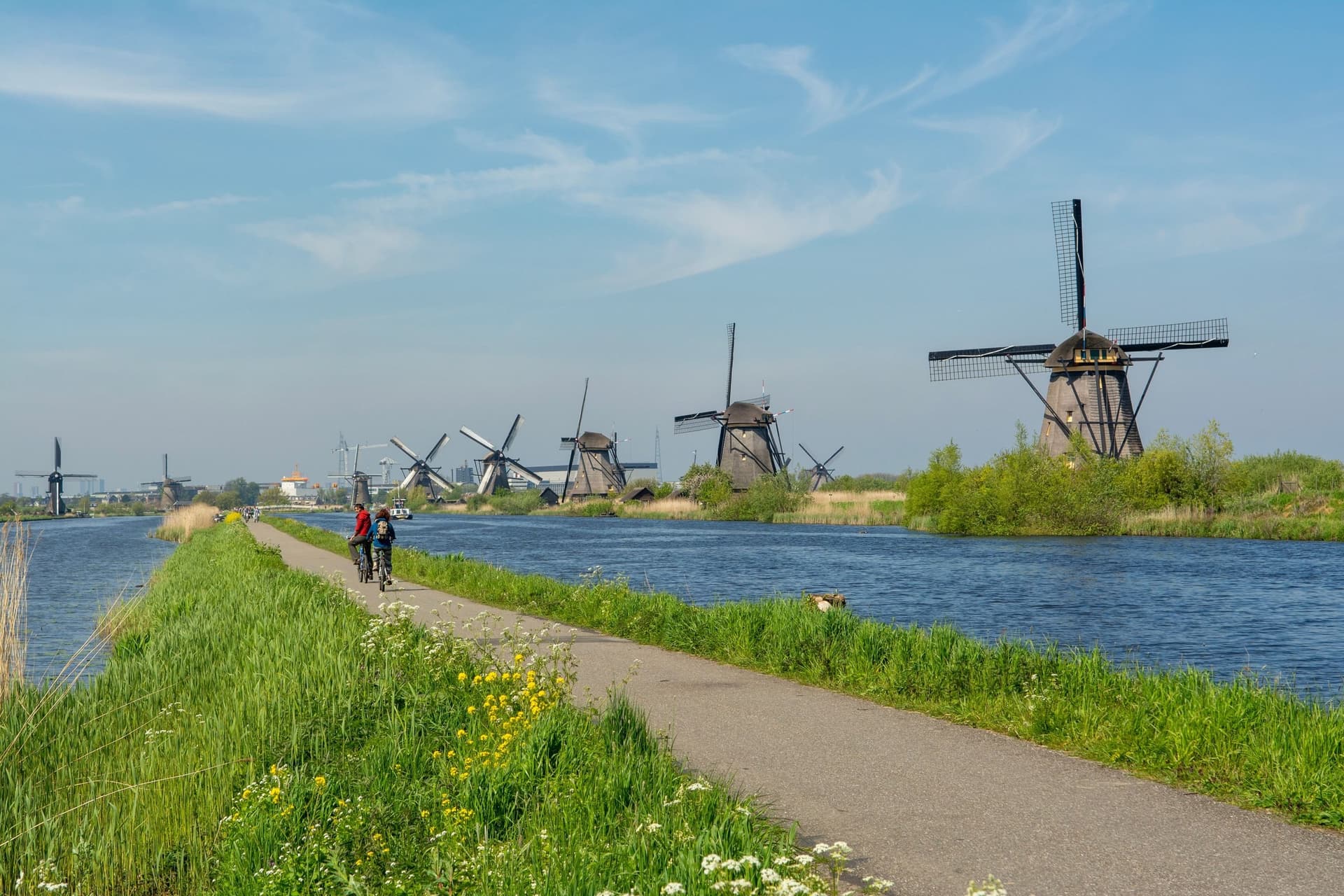
Near the end, the 19 drainage mills of Kinderdijk have been a UNESCO site since 1997, and Rotterdam's port leads the last 32.5 km to the Hook of Holland. Check the wind and the ferry timetables before each Dutch day; EuroVelo puts the best months here at April to September.
How Hard Is the Rhine Cycle Route?
Cycling along the Rhine needs stamina more than skill. The Alpine part climbs and descends hard, and almost everything from Constance to the sea is flat or gently rolling.
Gradients and Surfaces
The real gradients are all in Part 1, where Cicerone's first stage drops 1,341 m in 52 km. Below Constance the climbs are short: vineyard hills on the High Rhine, and the Veluwe and the Utrechtse Heuvelrug in the Netherlands.
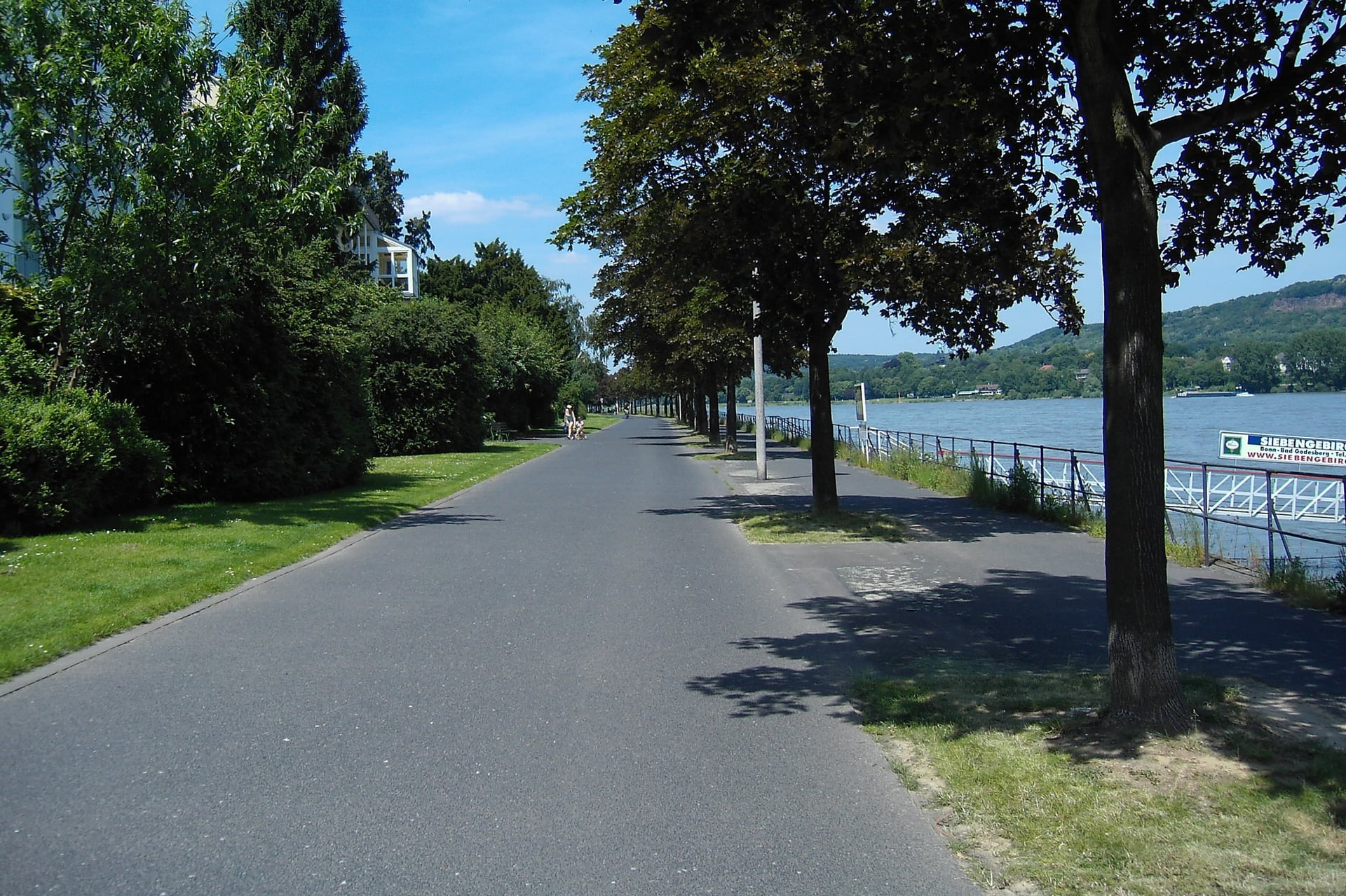
EuroVelo rates the surface on 86% of the certified 1,287 km as perfectly or well rideable, and below Koblenz the paths are wide and paved, as through Bonn. Most of the gravel and rough track is in Switzerland and on the German bank between Basel and Breisach, so tyres of 32 mm or wider make the ride more comfortable.
Traffic and Safety
EuroVelo counts 87% of the certified route with no or very low traffic, and 73% suits all riders, including families and bikes with trailers. The exceptions are the road from Andermatt to Breil/Brigels, recommended for experienced riders only, and the narrow parts of the gorge, where the path runs beside the road.
Signs, Banks and Ferries
The route is signed with the EuroVelo 15 logo, the number in a ring of 12 yellow stars on a blue panel, and in Switzerland as national route 2. EuroVelo first certified it in 2014, and the current certificate runs to September 2030.
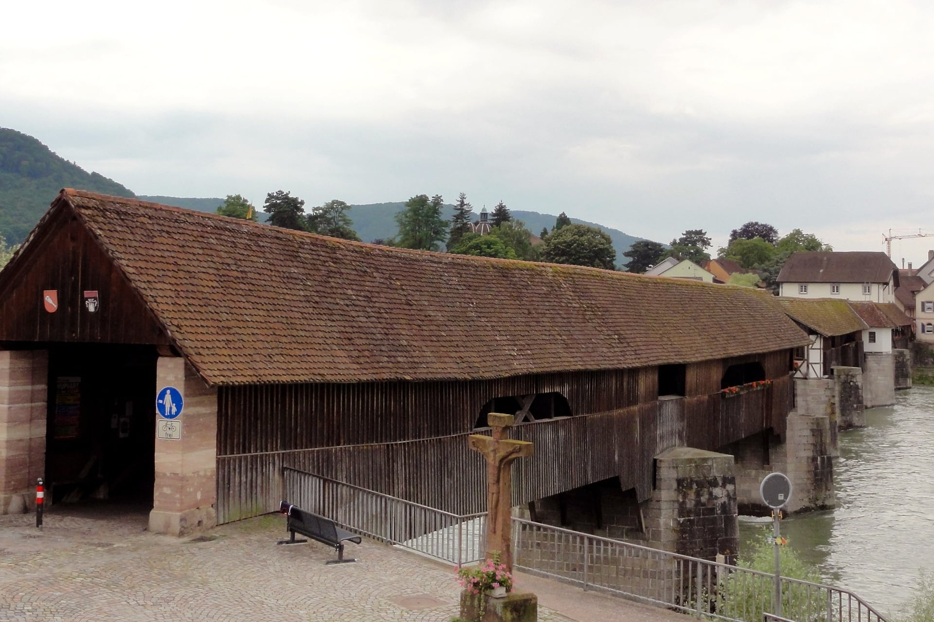
Long stretches are signed on both banks, and bridges and ferries let you switch. On the Upper Rhine the Rhinau ferry crosses every 15 minutes and costs nothing. Signs still go missing in towns, so carry the free GPX tracks from EuroVelo's map.
Between Basel and Strasbourg, riders disagree about which bank to take.
The French canal bank: paved, flat and quiet, but straight for long stretches
The German bank: gravel in places, with more variety and the Markgräflerland wine country beside it
The Alsace Vineyard Cycle Route: 131.5 km from Marlenheim to Thann at the foot of the Vosges, through wine villages with short climbs
When to Cycle the Rhine Cycle Route
The season moves with the altitude: the Alps open last and close first, while the Upper Rhine and Alsace can be ridden from early spring. Figures are Open-Meteo averages for 2016 to 2025, for Strasbourg unless another town is named.
April and May: highs of 16 °C and 20 °C. Snow can lie between Andermatt and Chur until May, and the Oberalp road opened on 25 April in 2026
June: 25 °C and the longest days; Constance averages 14 rain days, more than Strasbourg, Koblenz or Rotterdam
July and August: 26 °C, with about 5 days above 30 °C in July and 7 in August; the Seenachtfest in Constance and the Rhein in Flammen fireworks in the gorge fill hotels
September: 22 °C and 10 rain days, Strasbourg's driest month, as the grape harvest begins in the vineyard sections
October: 16 °C and 12 rain days, with 15 in Rotterdam at the Dutch end
November to March: 6 to 12 °C and snow on the Alpine passes; France Vélo Tourisme says the Alsace section can be ridden all year, with care in the coldest months
For most riders, May, June and September give warm days on quieter paths. Leave the Alpine part until late May, once the pass road is open and the snow has gone, and book July and August rooms early.
Know Before You Arrive
Trains run beside most of the river, beds are rarely far apart, and the route itself costs nothing to ride.
Getting There and Back
Strasbourg is the easiest place to reach from France, and the fastest TGV from Paris takes 1 hour 45. From London, Eurostar carries a bike to Paris only in a box or a bag, and a bagged bike travels free on TGV INOUI trains.
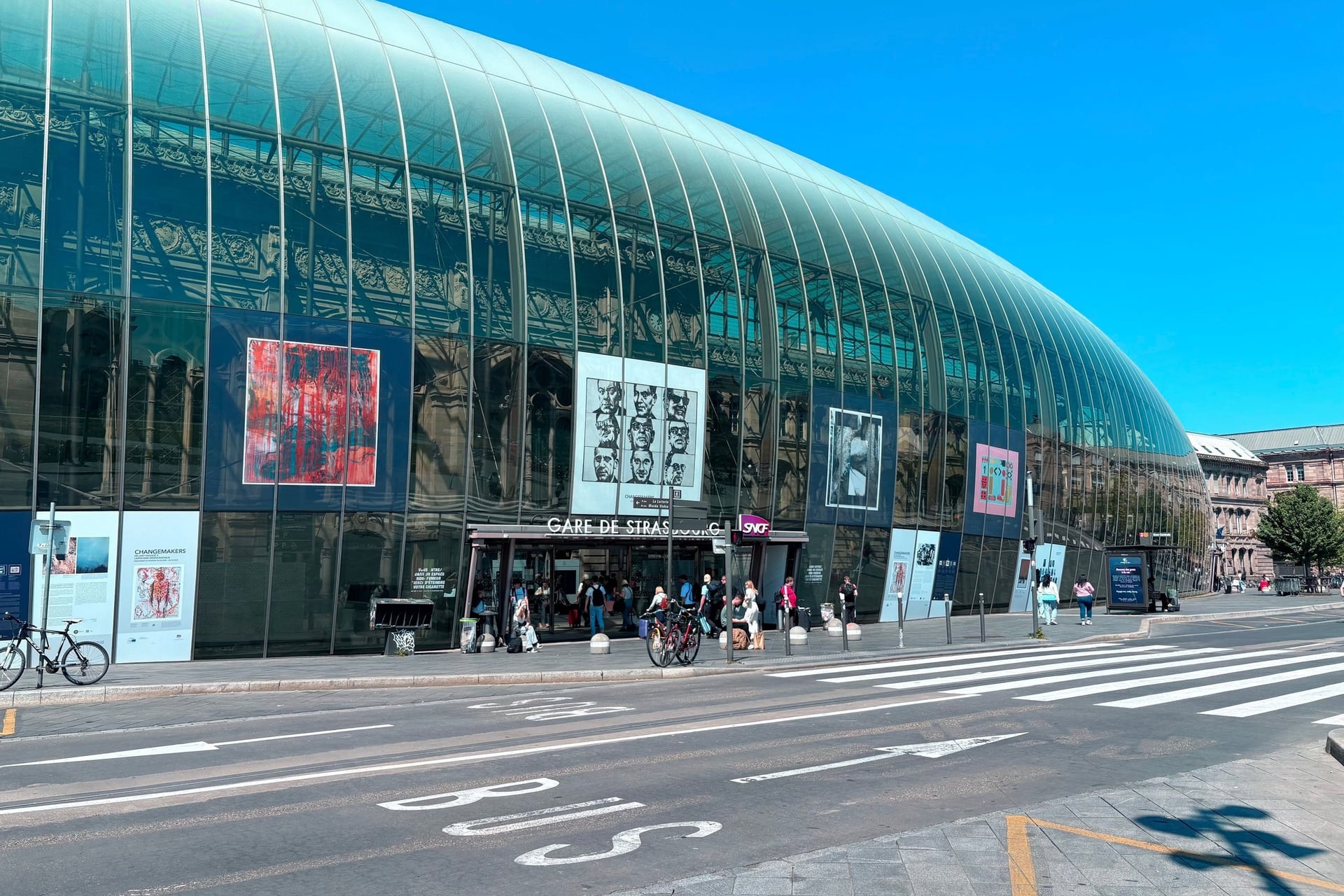
France: TGV INOUI trains take an assembled bike only with a reserved space; SNCF's TER trains in Alsace carry bikes without booking
Switzerland: InterCity trains need a bike space reservation from 21 March to 31 October; trains climb from Andermatt to the Oberalp Pass in 21 minutes
Germany: IC, EC and ICE trains need a bike ticket and a reserved space; regional trains need only a bike ticket
The High Rhine: the German line between Rheinfelden and Erzingen has been closed since 26 April 2026, and as far as Basel Badischer Bahnhof since 10 October, until December 2027. Replacement buses take no bikes, but on the Swiss bank S-Bahn line S1 links Laufenburg and Basel in 38 minutes
The Middle Rhine: the right-bank railway between Wiesbaden and Troisdorf is closed for renovation from July to December 2026, with no bikes on the replacement buses
By air: Zurich for Constance, about an hour by train; from EuroAirport Basel-Mulhouse-Freiburg, bus 50 runs to Basel SBB every 7 to 10 minutes
By ferry: Stena Line sails from the Hook of Holland to Harwich and takes bikes
Where to Stay
Most nights end in a small river town with a half-timbered inn, and from Lake Constance to the sea the towns lie close together. Each country marks the beds that welcome cyclists, with secure bike storage as the minimum.
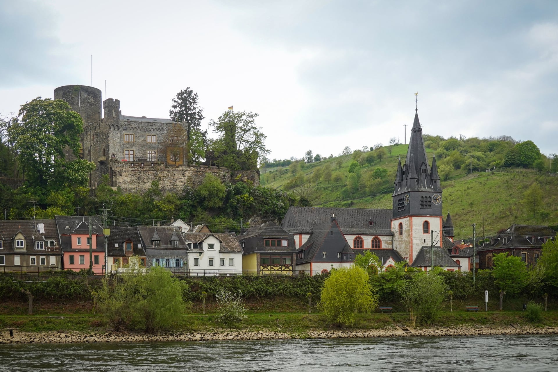
In France, look for the Accueil Vélo label: 34 hosts on the Alsace section offer secure bike parking, luggage storage, a repair kit and overnight e-bike charging. Germany uses Bett+Bike, and the Netherlands Fietsers Welkom!.
Cicerone counts 35 Hostelling International youth hostels along the river, and Burg Stahleck above Bacharach puts 178 beds inside a castle. Campsites line the banks, but book July and August early, especially for Rhein in Flammen nights in the gorge.
How Much Does It Cost?
The route is free to ride, and the money goes on beds, trains and a few sights. In Switzerland you pay in Swiss francs, and your bike needs its own ticket on Swiss trains.
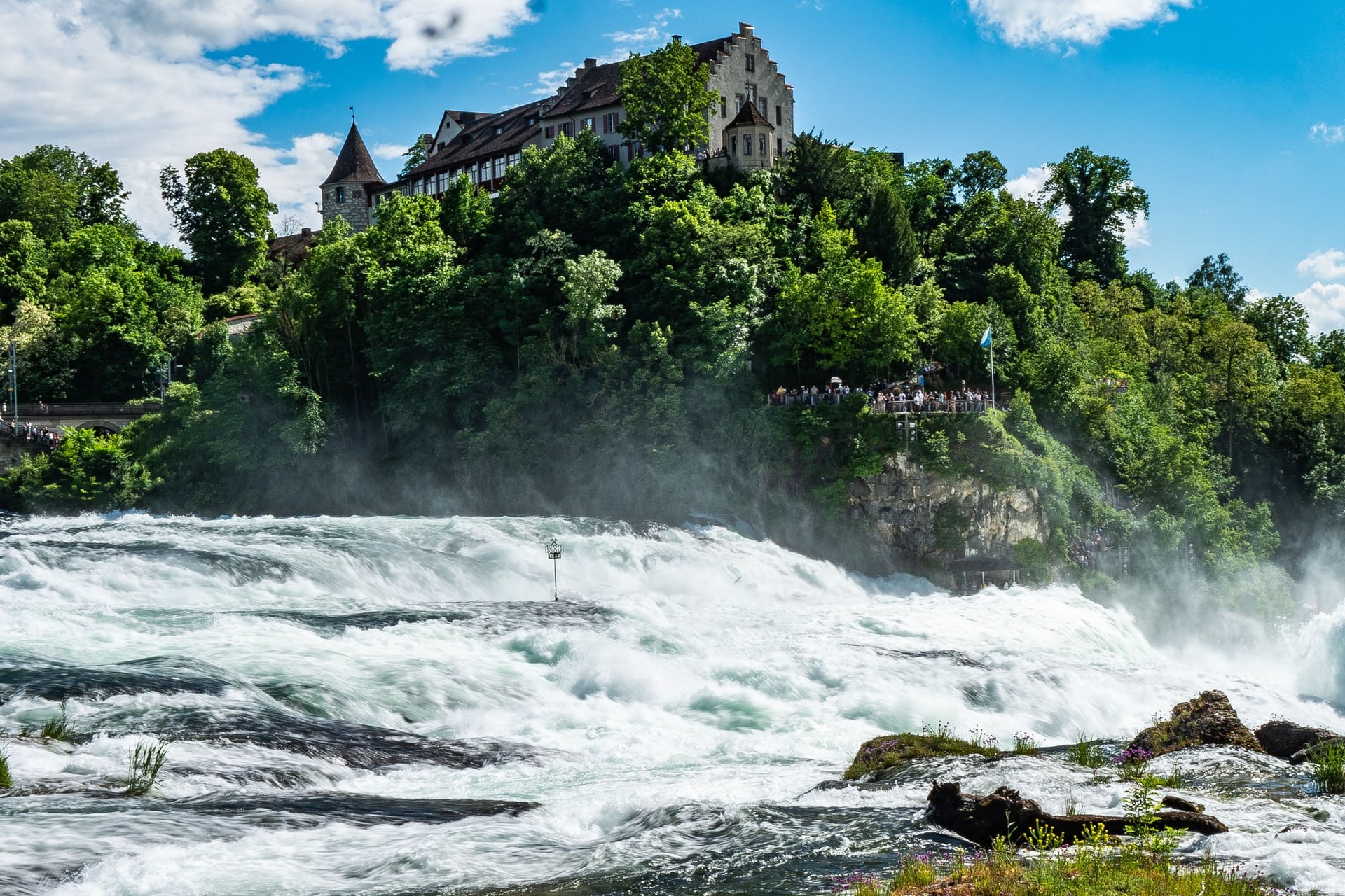
Rhine Falls: free from Schlössli Wörth at Neuhausen; CHF 5 at Schloss Laufen, including the viewing platforms and the Historama
Rhinau ferry: free, every 15 minutes
Swiss trains: a Bike Day Pass costs CHF 15, rising to CHF 16 from 13 December 2026, plus CHF 2 for a space on InterCity trains that need one
German trains: a long-distance bike ticket costs €7.99 to €14.99, depending on distance
French trains: an assembled bike costs €10 on TGV INOUI; a bagged bike, and any bike on a TER train, travels free
Bike hire in Strasbourg: Vélhop charges €7 a day for a standard bike and €14 for an e-bike
What to Pack
Strasbourg averages 10 to 13 rain days a month from April to October, July and August bring hot afternoons, and the route starts at 2,046 m, so pack for all three.
For any multi-day ride:
Waterproof jacket and a warm layer for mornings
Spare tubes, pump and a multi-tool
Lights, a bell and reflectors, which French law requires, and a high-visibility vest outside towns after dark
For the Rhine Cycle Route:
Tyres of 32 mm or wider for the gravel in Switzerland and on the German bank
A lock for town and cathedral stops
Swim kit for the Rhine at Basel and the lakes
Swiss francs or a card, and a phone plan that covers Switzerland, which is outside the EU
A helmet for children under 12, compulsory in France and Austria
Which Week for a First Rhine Ride?
The whole river takes three to four weeks, so most riders choose one week. Constance to Strasbourg fits into seven riding days and takes in the Rhine Falls, the covered bridges of the High Rhine, the Black Forest wine villages and the canal into Strasbourg.
In 2026 that stretch is harder to ride on your own. The German railway along the High Rhine is closed until December 2027, and replacement buses take no bikes, so skipping a day or getting back to the start needs planning.
Our self-guided Rhine River Bike Tour rides this stretch with the hotels booked and the bags moved.
Duration: 9 days and 8 nights, April to October
Route: Constance to Strasbourg, 370 km over 7 riding days of 40 to 65 km, with 1,750 m of elevation gain in all
Nights: Constance, Schaffhausen, Waldshut, Basel, Badenweiler, Breisach, Ettenheim and Strasbourg, in 3-star hotels with breakfast
From Basel the tour leaves the river for two days, through the Markgräflerland vineyards to Badenweiler, Staufen and Freiburg, and rejoins it at Breisach. We move your luggage each day and give you a GPS app, a digital guidebook and support while you ride; bike hire is extra. Ask us about dates for next season.
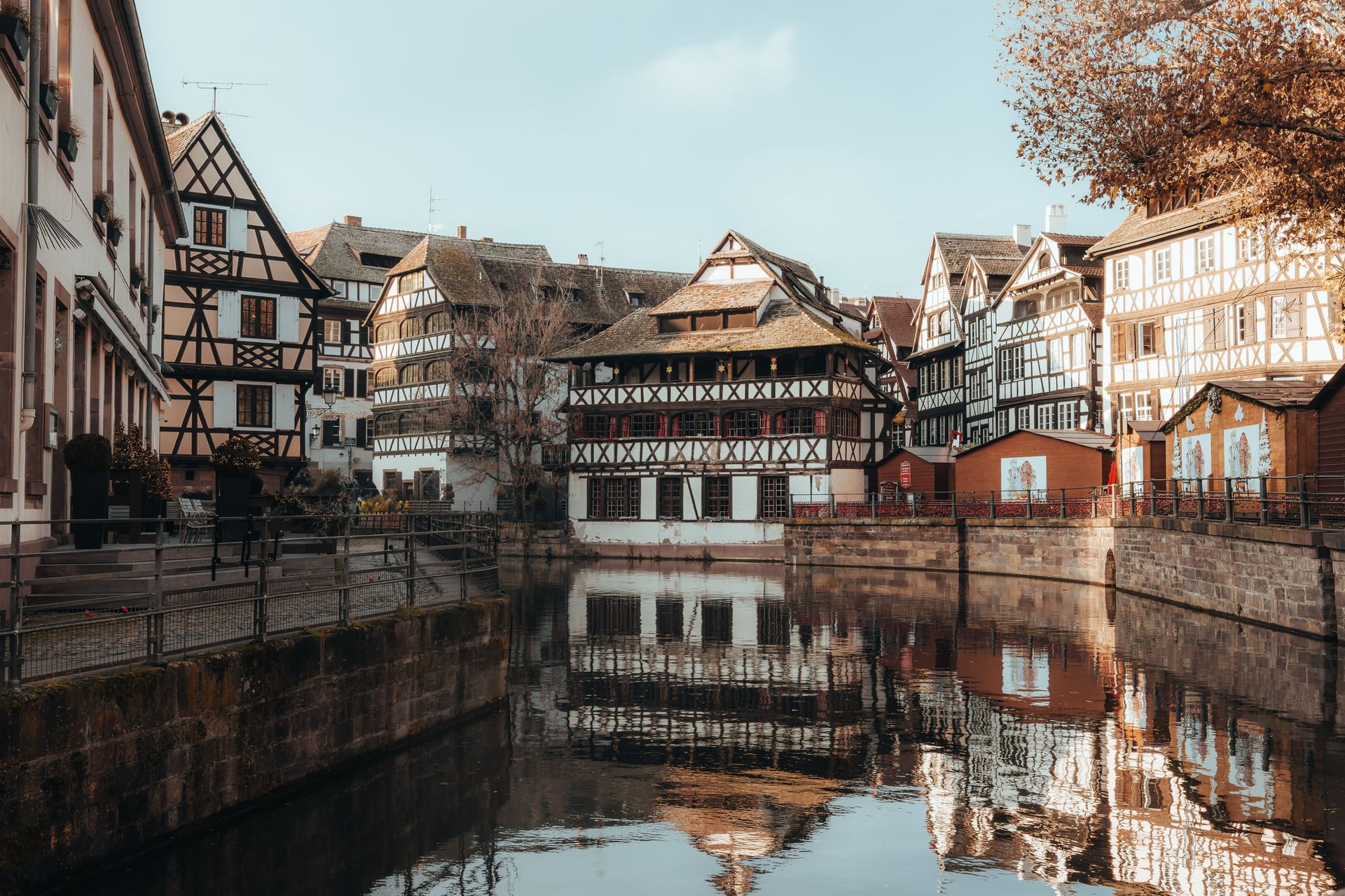
In Strasbourg the towpath ends among the half-timbered houses of Petite France, and the Rhine flows on for more than 800 km to the North Sea at the Hook of Holland.
Frequently Asked Questions



Plan with a cycling expert
Free advice from a team that knows these routes inside out - real people, not a bot

Hassle-Free
We take care of route planning, accommodations, luggage transfers, and all logistics, so you can focus purely on enjoying your ride.

Tried & Tested Adventures
Our cycling routes are hand-picked & tested, to ensure breathtaking landscapes, smooth roads, and maximum safety - giving you the perfect ride every day.

Unbeatable Support
Our 24/7 customer support is where we show our passion, ensuring your cycling holiday runs smoothly and your well-being is always our top priority.

Book with Confidence
We are a financially protected company, fully bonded and insured, keeping your money safe and allowing you to travel with confidence.