Cycling in France: 10 Best Regions and Long-Distance Routes
The ten best regions to cycle in France, from the flat Loire to the Alpine cols, with each signed route's distance, elevation gain, riding season and trains.
Quick links
Don't want to read all this?
We've planned 800+ cycling trips. Send your dates, fitness and group size — we'll map the route and book every night.


France lets anyone ride the roads of the Tour de France. You can climb the 21 hairpins of Alpe d'Huez or the white scree of Mont Ventoux, then spend the next day on a riverside path past Loire châteaux, with lunch in a village square.
Most of the riding is gentler than that reputation. France Vélo Tourisme counts more than 30,000 km of signed cycle routes, many on river paths, canal towpaths and old railway lines, and a first week in France rarely needs a mountain.
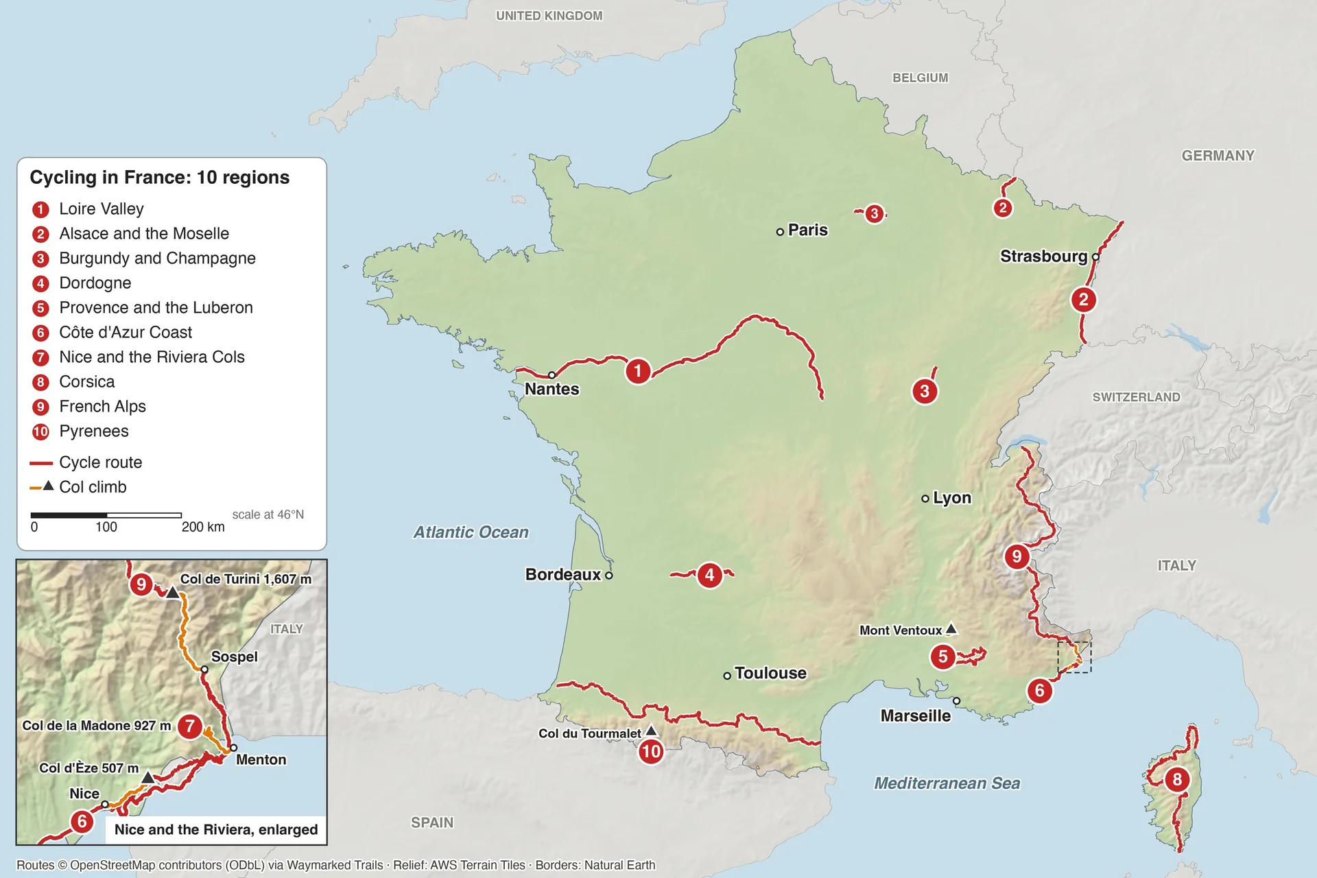
The ten best regions run from the flattest, the Loire and Alsace, to the highest, the Alps and the Pyrenees.
The 10 Best Cycling Regions in France
A 20 km day between Loire châteaux and a 19 km climb to the Col du Tourmalet are both French cycling. The ten regions run in order from the flattest riding to the highest cols.
1. Loire Valley
Signature route: La Loire à Vélo, part of EuroVelo 6
Distance: 900 km of signed route: 630 km from Nevers to Saint-Brevin-les-Pins on the Atlantic, plus 270 km of loops
Elevation gain: 783 m over the 630 km; 37% on cycle paths, the rest on quiet roads
Highest point: 185 m
Getting there: stations along the river at Orléans, Blois, Tours, Saumur, Angers and Nantes
Where to stay: hotels and chambres d'hôtes in Blois, Amboise, Tours, Saumur and Montsoreau, all on the route
Best for: a first cycling holiday, châteaux and wine
Riding season: April to October
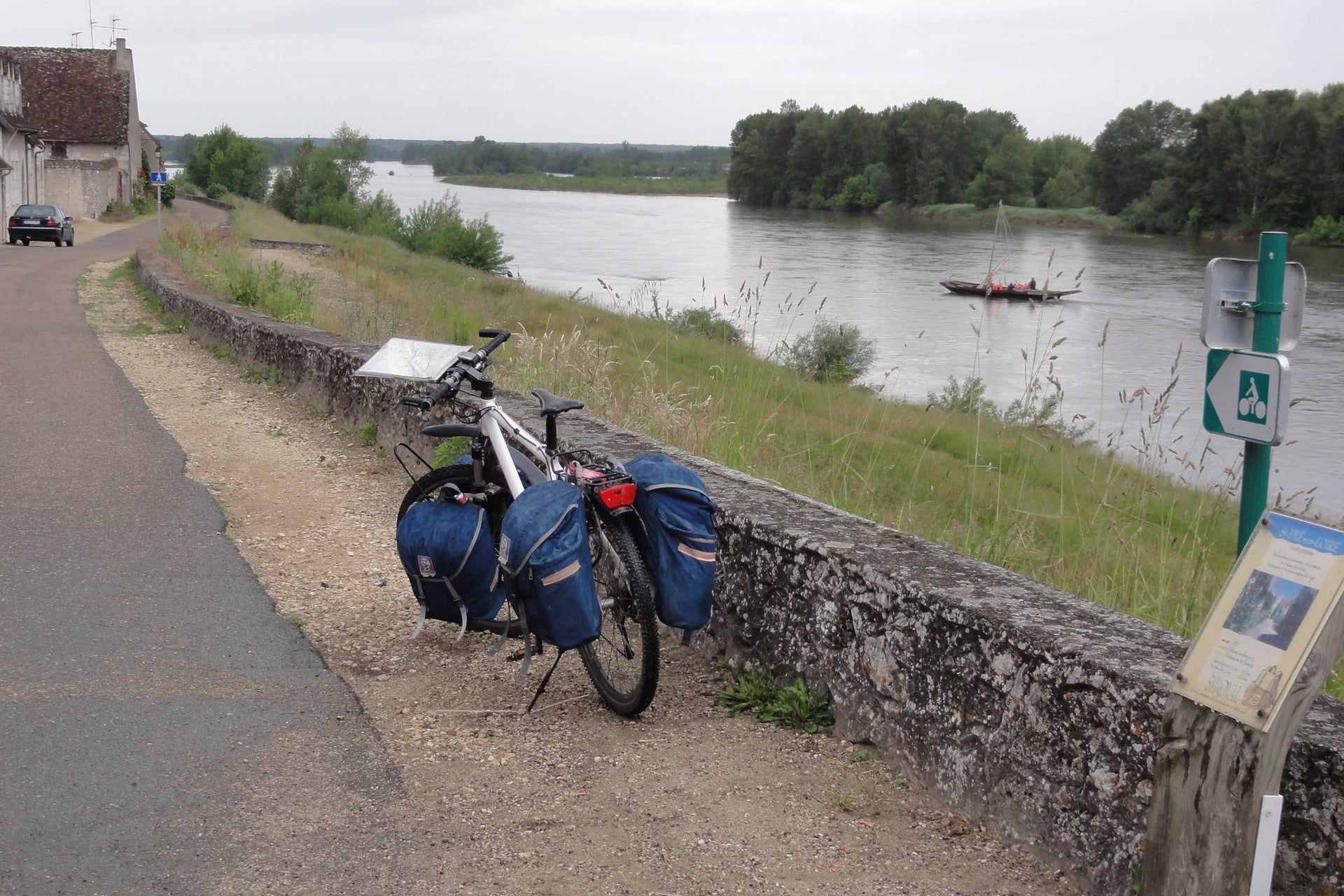
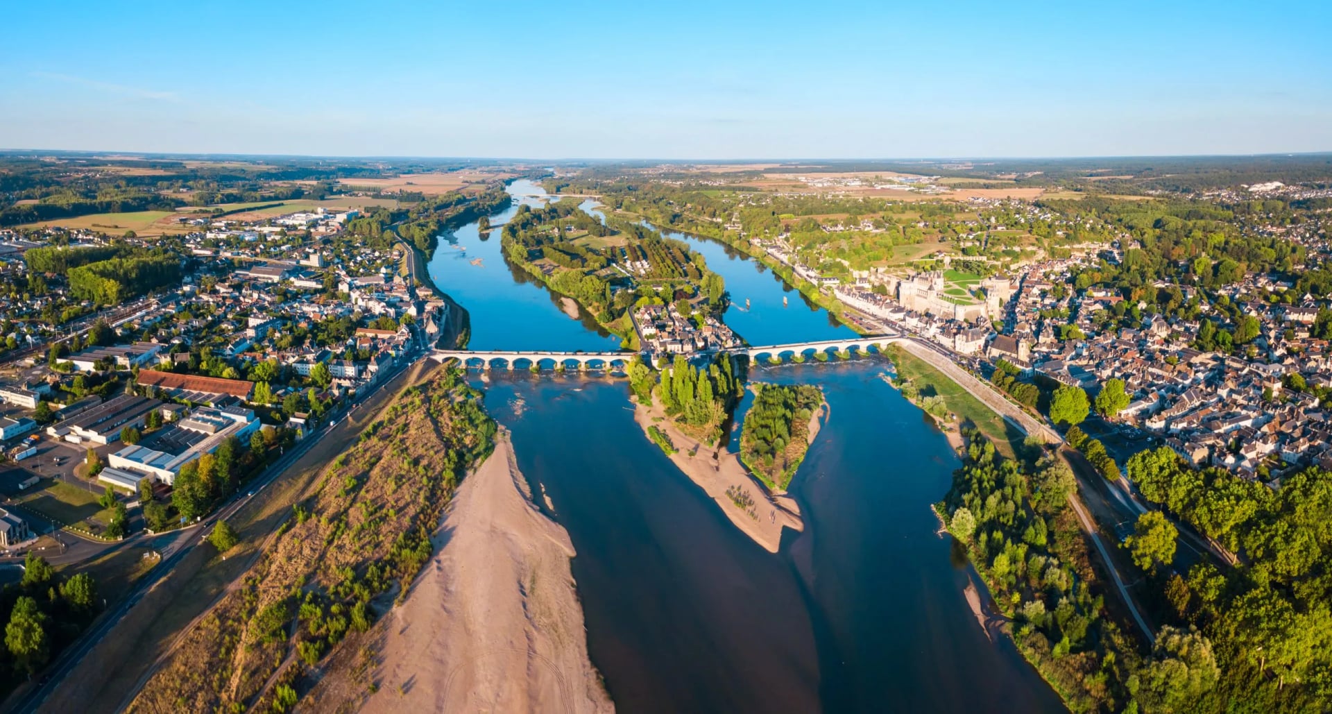
La Loire à Vélo follows the Loire from Burgundy to the Atlantic on levees, towpaths and quiet roads. Between Sully-sur-Loire and Chalonnes-sur-Loire, 280 km of the valley is a UNESCO World Heritage landscape, and most of the great châteaux stand on or near the route: Chambord, Blois, Amboise and Saumur among them.
With 783 m of elevation gain spread over 630 km, almost every day is flat. Interloire trains link Orléans, Blois, Tours, Saumur, Angers and Nantes, with a carriage for bikes in summer, so you can ride one way and take the train back.
Full guide: The Loire Valley cycle route
2. Alsace and the Moselle
Signature route: EuroVelo 15, the Rhine Cycle Route, and La Voie Bleue (V50) along the Moselle
Distance: 180 km on EuroVelo 15 from Huningue, near Basel, to Lauterbourg; La Voie Bleue runs 700 km from Apach, on the Luxembourg border, to Lyon
Elevation gain: 33 m on EuroVelo 15 in Alsace, 76% of it on cycle paths
Highest point: 252 m on EuroVelo 15
Getting there: EuroAirport Basel-Mulhouse, and TGV stations at Strasbourg, Colmar and Metz
Where to stay: Strasbourg on EuroVelo 15, Colmar for the wine villages, and Thionville or Metz on the Moselle
Best for: long, flat days away from traffic, with wine villages close by
Riding season: April to October
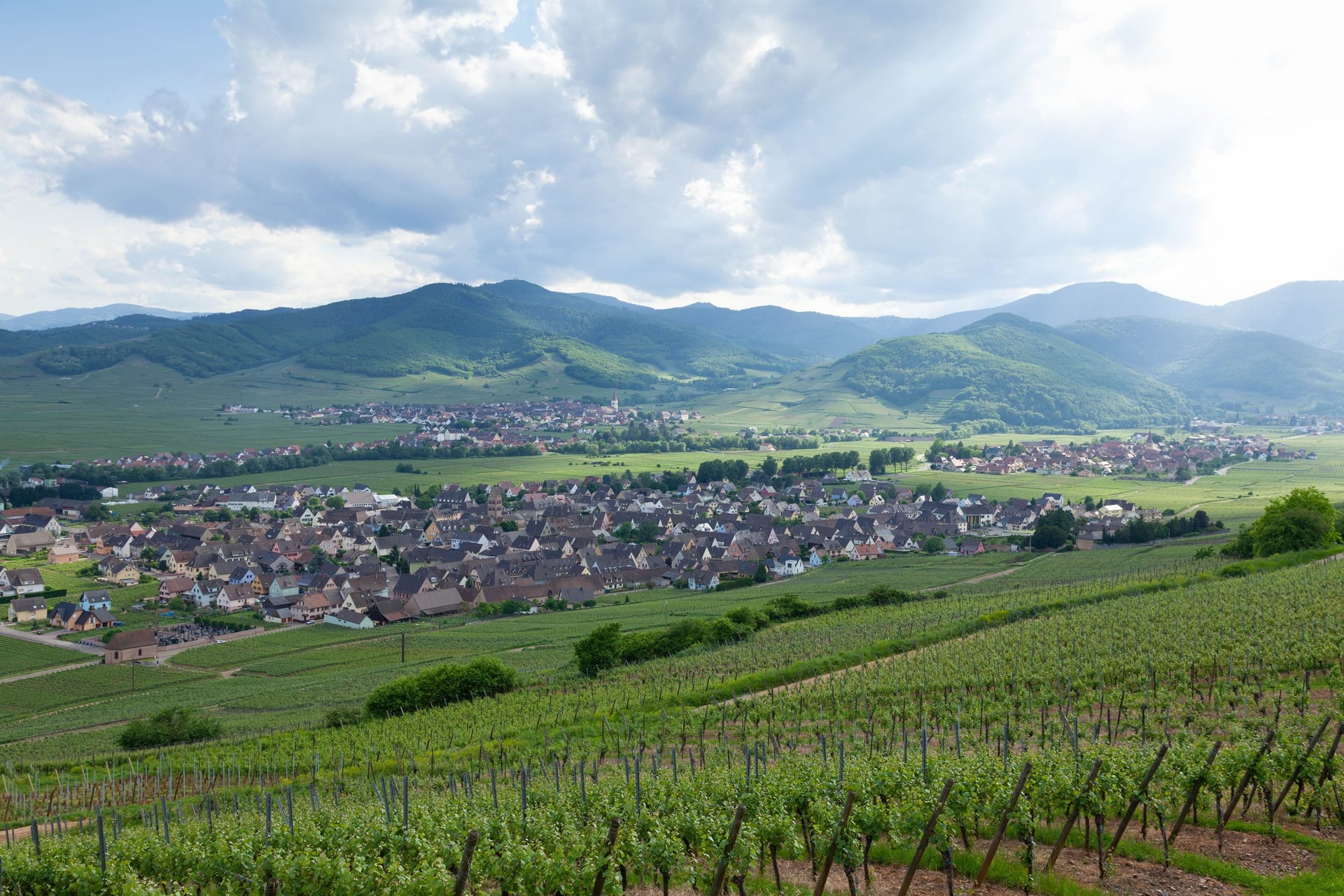
Alsace is the flattest of the ten regions, and EuroVelo 15 gains only 33 m in 180 km. It follows the Canal du Rhône au Rhin and the Rhine itself, the border with Germany, past Vauban's fortress town of Neuf-Brisach and into Strasbourg, both UNESCO World Heritage Sites.
West of the Rhine plain, EuroVelo 5 shares the vineyard route along the foot of the Vosges, through the wine villages around Colmar. Further north, La Voie Bleue starts at Apach and follows the Moselle through Thionville to Metz, signed V50 all the way to Lyon.
Full guide: The Rhine cycle route
3. Burgundy and Champagne
Signature route: La Voie des Vignes in Burgundy and the Marne valley route (V52) in Champagne
Distance: 72 km from Dijon to Santenay on the Voie des Vignes; about 45 km on the V52 between Dormans and Condé-sur-Marne, through Épernay
Elevation gain: short climbs between vineyards; the 664 km Tour de Bourgogne loop gains 1,416 m
Highest point: about 300 m on the Voie des Vignes, near Gevrey-Chambertin
Getting there: trains from Paris to Dijon and Beaune for Burgundy, and to Reims and Épernay for Champagne
Where to stay: Dijon, Nuits-Saint-Georges and Beaune on the Voie des Vignes, and Épernay on the Marne
Best for: wine villages with short climbs between them
Riding season: April to October, with the grape harvest usually in September
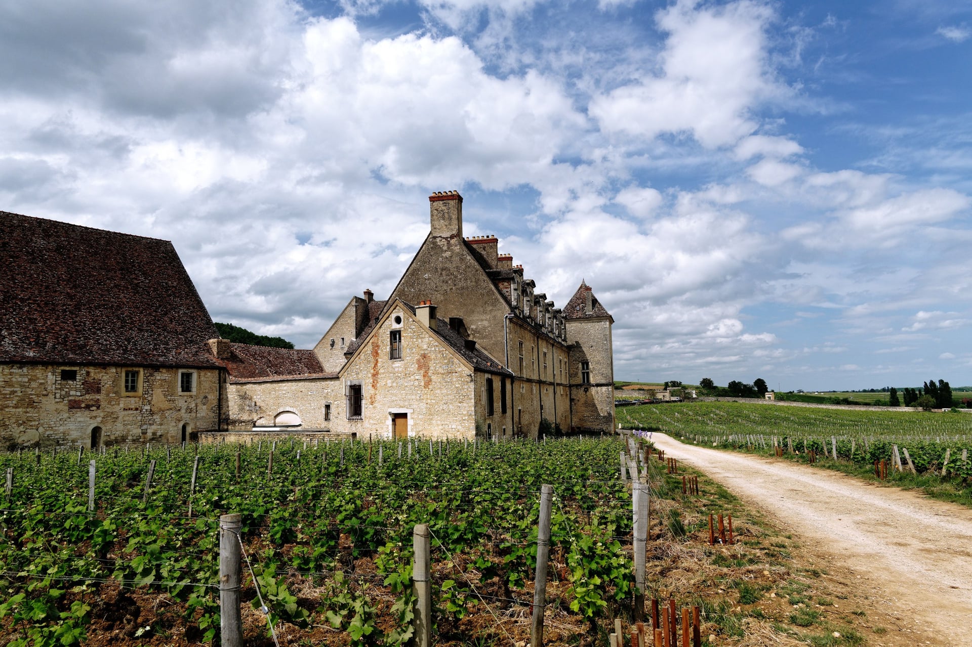
Burgundy and Champagne are the two great wine regions within easy reach of Paris. In Burgundy the Voie des Vignes runs below the Côte de Nuits and the Côte de Beaune. This strip of vines, about 3 km wide and 60 km long, holds more than 1,000 named plots, the Climats, which are UNESCO-listed.
In Champagne the riding is gentler along the Marne. The V52 stays beside the river through Épernay, below the vine slopes of the Montagne de Reims. The hillsides, houses and cellars of Champagne joined the UNESCO list in 2015, the same year as the Climats.
Full guide: Cycling in Burgundy
4. Dordogne
Signature route: the Véloroute de la Vallée de la Dordogne (V91)
Distance: a véloroute still being completed from Lacave, in the Lot, to the Gironde, with 40 km of greenway from Mauzac to Prigonrieux near Bergerac
Elevation gain: little along the river; short, steep climbs to hilltop villages such as Domme
Highest point: about 160 m along the valley road, near Lacave
Getting there: Bergerac airport, and regional trains from Bordeaux to Bergerac and Sarlat
Where to stay: Beynac and Souillac in the valley, and Sarlat, 6 km from the river
Best for: castles, cliff villages and prehistoric caves
Riding season: April to October
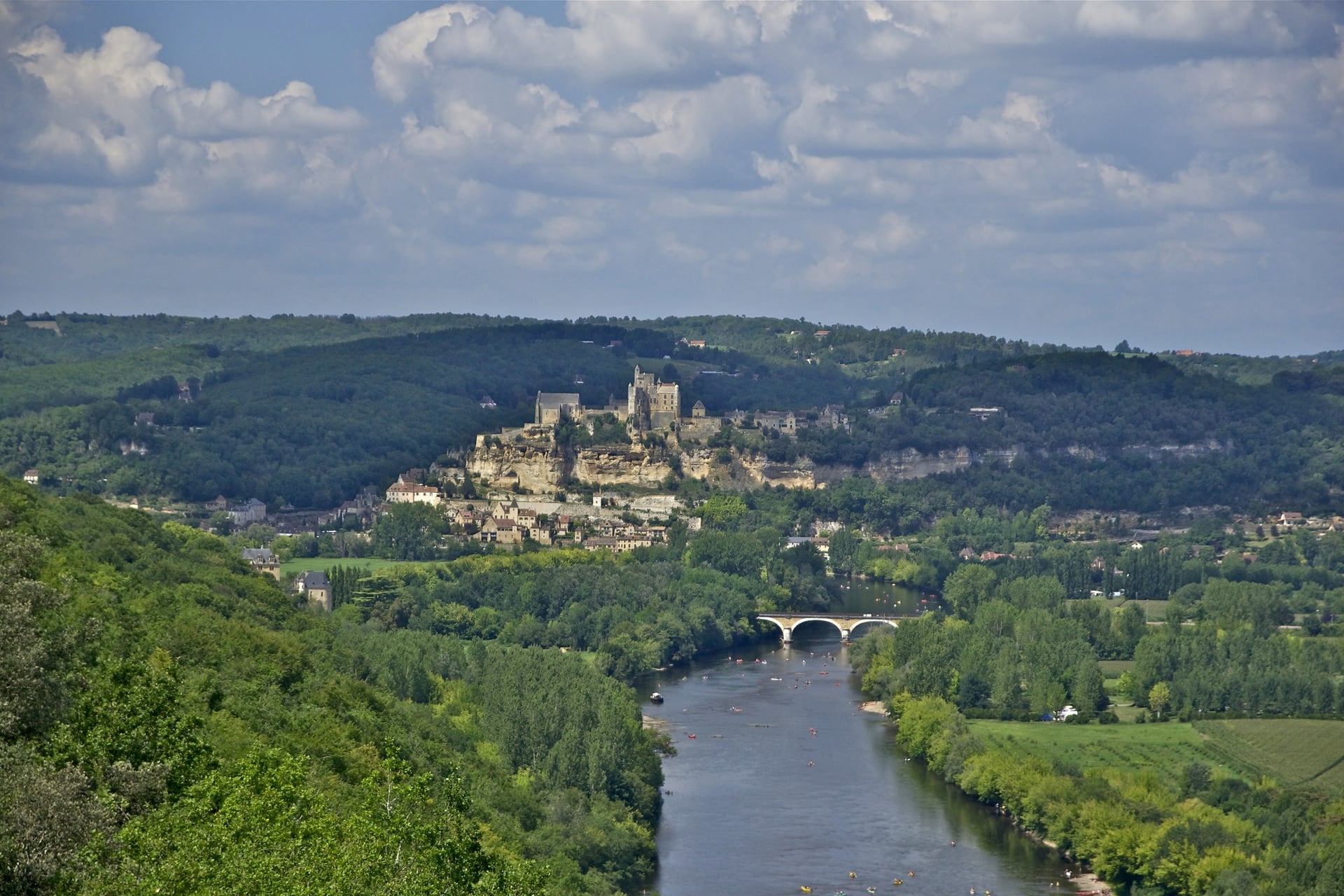
Castles and cliff villages line the Dordogne between Souillac and Siorac: Beynac and Castelnaud face each other across the water, and La Roque-Gageac sits under its cliff upstream. The V91 véloroute follows the valley, and the riding gets harder wherever a lane leaves the river for a hilltop village such as Domme.
Prehistory is the other reason to come. The Vézère, which joins the Dordogne at Limeuil, has UNESCO-listed prehistoric sites and decorated caves, including Font-de-Gaume at Les Eyzies. At Montignac, Lascaux IV is a full-size replica of the painted cave, with paintings made more than 17,000 years ago.
5. Provence and the Luberon
Signature route: Autour du Luberon à vélo
Distance: 241 km loop from Cavaillon through Lourmarin, Manosque, Forcalquier, Apt and Bonnieux
Elevation gain: 2,670 m on the loop; about 15 km on greenways, the rest on quiet roads
Highest point: 782 m on the loop; 1,910 m on Mont Ventoux
Getting there: Avignon TGV, with regional stations at Cavaillon and Manosque
Where to stay: Lourmarin, Bonnieux, Apt and Forcalquier on the loop, and Bédoin at the foot of Mont Ventoux
Best for: hill villages, markets and Mont Ventoux
Riding season: April to June and September to October; the Ventoux summit road closes from mid-November to spring
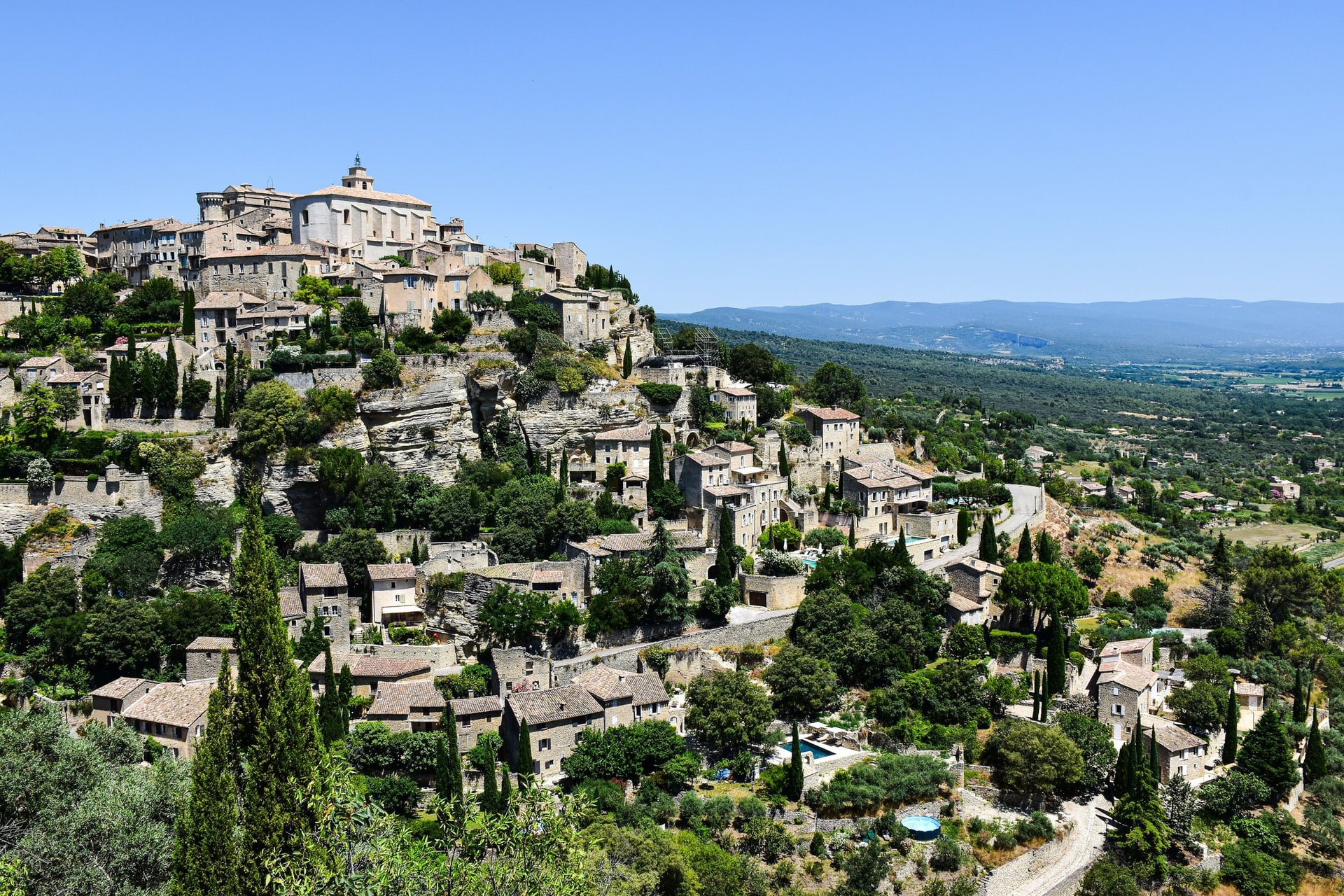
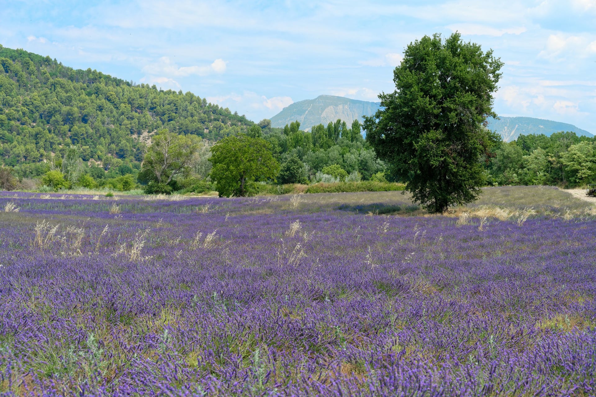
Provence mixes stone hill villages, lavender and one real mountain. The Luberon loop links Lourmarin, Bonnieux and Ménerbes on quiet roads, and its 2,670 m of elevation gain comes in short climbs between villages. Gordes and Roussillon, with its ochre cliffs, sit less than 10 km north of it.
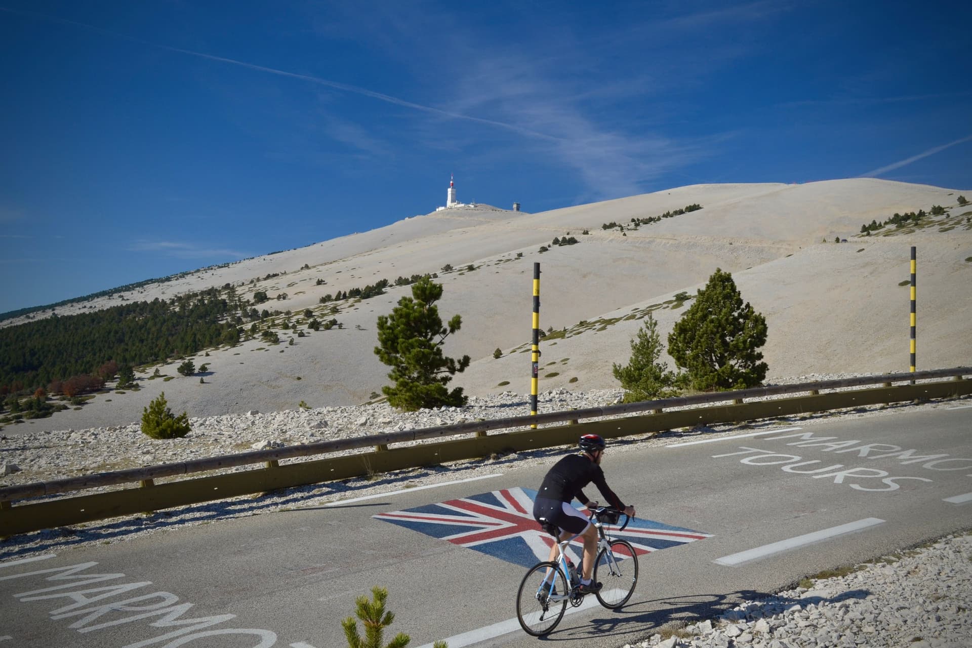
North of the Luberon, Mont Ventoux rises to 1,910 m. From Bédoin the classic ascent gains 1,598 m in 21.8 km, first through forest and then over bare white scree. On its southern side, the Gorges de la Nesque road is a gentler balcony ride.
Full guide: Cycling in Provence
6. The Côte d'Azur Coast: Esterel to Menton
Signature route: the coast road from Saint-Raphaël to Menton, over the Corniche d'Or
Distance: about 105 km from Saint-Raphaël to Menton along the shore
Elevation gain: about 740 m, in short rises over the headlands
Highest point: about 120 m, on the Basse Corniche east of Nice
Getting there: Nice Côte d'Azur airport, and coast-line stations at Saint-Raphaël, Cannes, Antibes, Nice and Menton
Where to stay: Saint-Raphaël, Cannes, Antibes, Nice and Menton, all on the coast road
Best for: sea views and warm riding in spring and autumn
Riding season: March to June and September to November
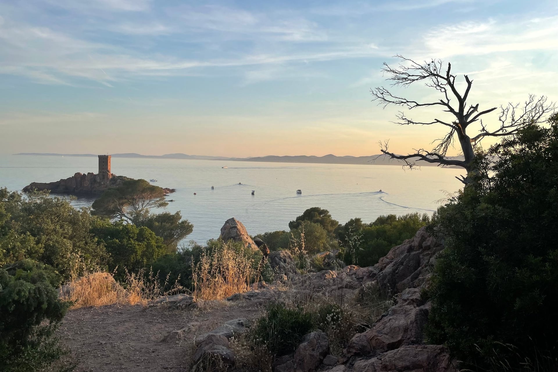
West of Cannes, the Corniche d'Or runs through the red volcanic rock of the Esterel above small coves, between Saint-Raphaël and Mandelieu-la-Napoule. The Touring Club de France had the road built between 1901 and 1903, and EuroVelo 8, La Méditerranée à Vélo, takes an inland line through the Var hills instead.
East of Nice, three corniche roads run one above the other to Menton on the Italian border, past Villefranche-sur-Mer, Èze and Monaco. July and August are the worst months on this coast, when the roads fill with traffic, while May and October average highs of 21 °C in Nice.
7. Nice and the Riviera Cols
Signature route: unsigned climbs from the coast: the Col d'Èze, the Col de la Madone and the Col de Turini
Distance: 10 km for the Col d'Èze from Nice, 14.5 km for the Madone from Menton, 24.1 km for the Turini from Sospel
Elevation gain: 500 m, 914 m and 1,244 m on those three climbs
Highest point: 1,607 m at the Col de Turini
Getting there: Nice Côte d'Azur airport, on the western edge of Nice
Where to stay: Nice for the Col d'Èze, Menton for the Madone, and Sospel at the foot of the Turini
Best for: mountain climbs outside the summer season
Riding season: all year on the Col d'Èze and the Madone; snow can close the Turini in winter
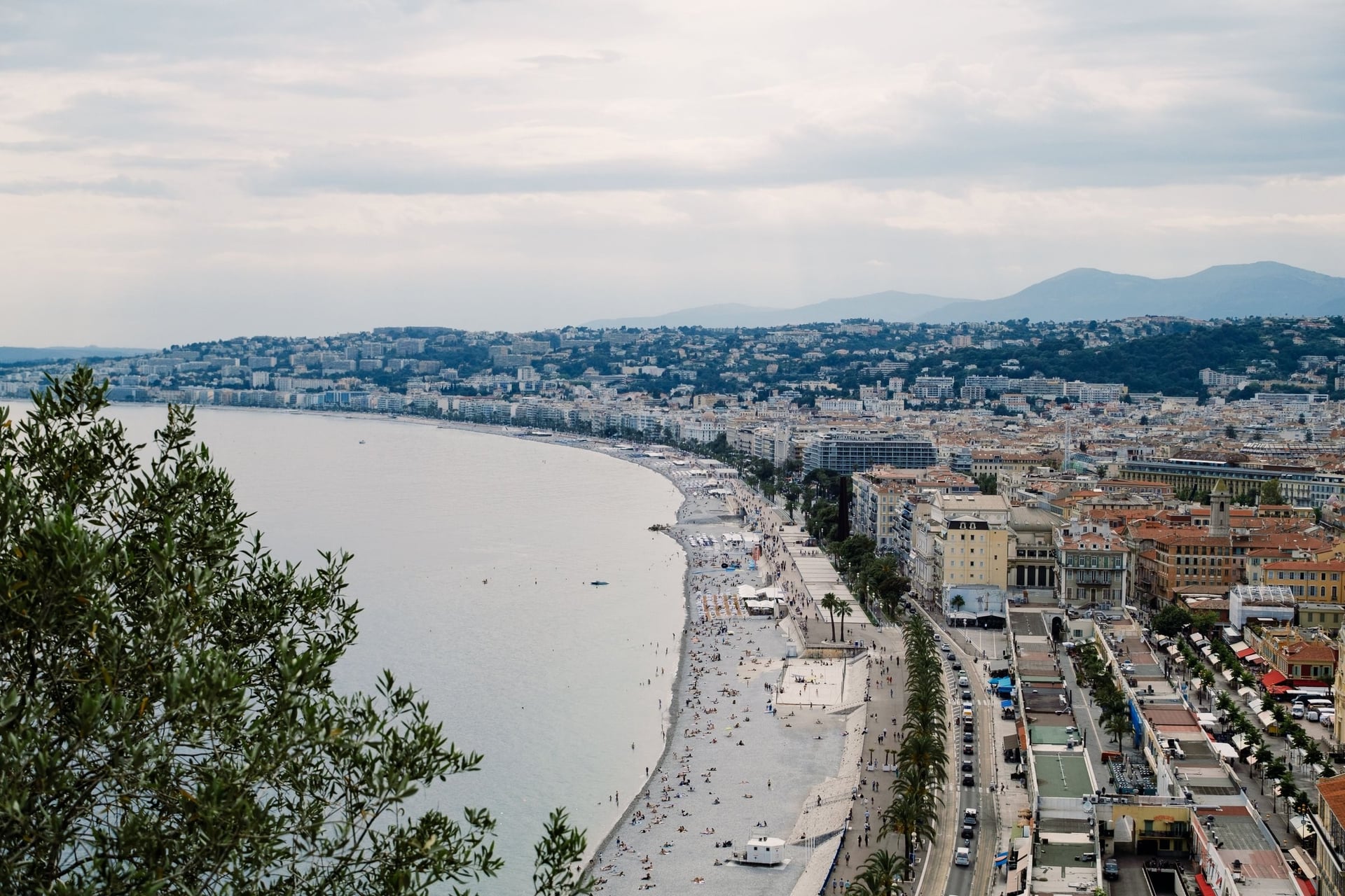
Nice suits riders who want mountains in winter and spring, because the cols start at sea level. The Col d'Èze climbs 10 km from the city at 5% to 507 m, and above Menton the Madone is the local professionals' test climb, 14.5 km at 6.3%.
Inland, the Col de Turini reaches 1,607 m on a road known from the Monte Carlo Rally, 24.1 km at 5.2% from Sospel. Winter riding works on this coast: even in January the average high in Nice is about 13 °C.
8. Corsica
Signature route: the GT20, the Grande Traversée of Corsica by bike
Distance: 592 km from Bastia to Bonifacio, signed in both directions
Elevation gain: 10,047 m, almost all on secondary roads shared with traffic
Highest point: 1,477 m at the Col de Vergio
Getting there: ferries from Marseille, Toulon and Nice, and airports at Bastia, Ajaccio, Calvi and Figari
Where to stay: Bastia, Porto, Corte, Zonza and Bonifacio, all on the GT20
Best for: fit riders who want mountains and sea on one island
Riding season: April to late June, and September to October
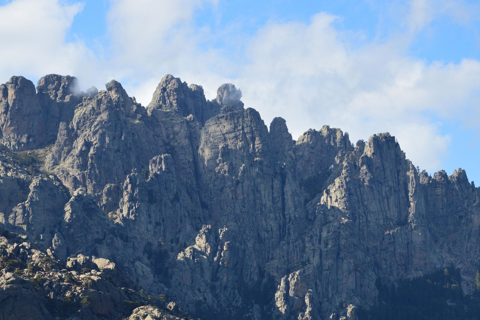
Corsica is a mountain range in the sea, and the GT20 crosses it from end to end. Between Bastia and Bonifacio the signed route goes over ten main passes, from the Col de Palmarella above the west coast to the Col de Vergio, the highest road pass on the island at 1,477 m.
Two famous roads lie just off the line: the red granite Calanques de Piana on the west coast, and the Col de Bavella, 1,218 m, climbed in 8.8 km at 5.1% from Zonza below its rock needles. Summer is the wrong season here, with average highs of 29 °C in Ajaccio in July and the most traffic.
Full guide: Cycling in Corsica
9. The French Alps
Signature route: the Route des Grandes Alpes by bike
Distance: 720 km from Thonon-les-Bains on Lake Geneva to Nice
Elevation gain: nearly 20,000 m on the main route, almost all on roads
Highest point: 2,764 m at the Col de l'Iseran
Getting there: Geneva airport, and 15 railway stations along the route, starting at Thonon-les-Bains
Where to stay: Thonon-les-Bains, Val d'Isère, Valloire, Briançon and Barcelonnette, all on the route
Best for: the Tour de France cols
Riding season: June to October on the highest passes; the valleys and lakes from April
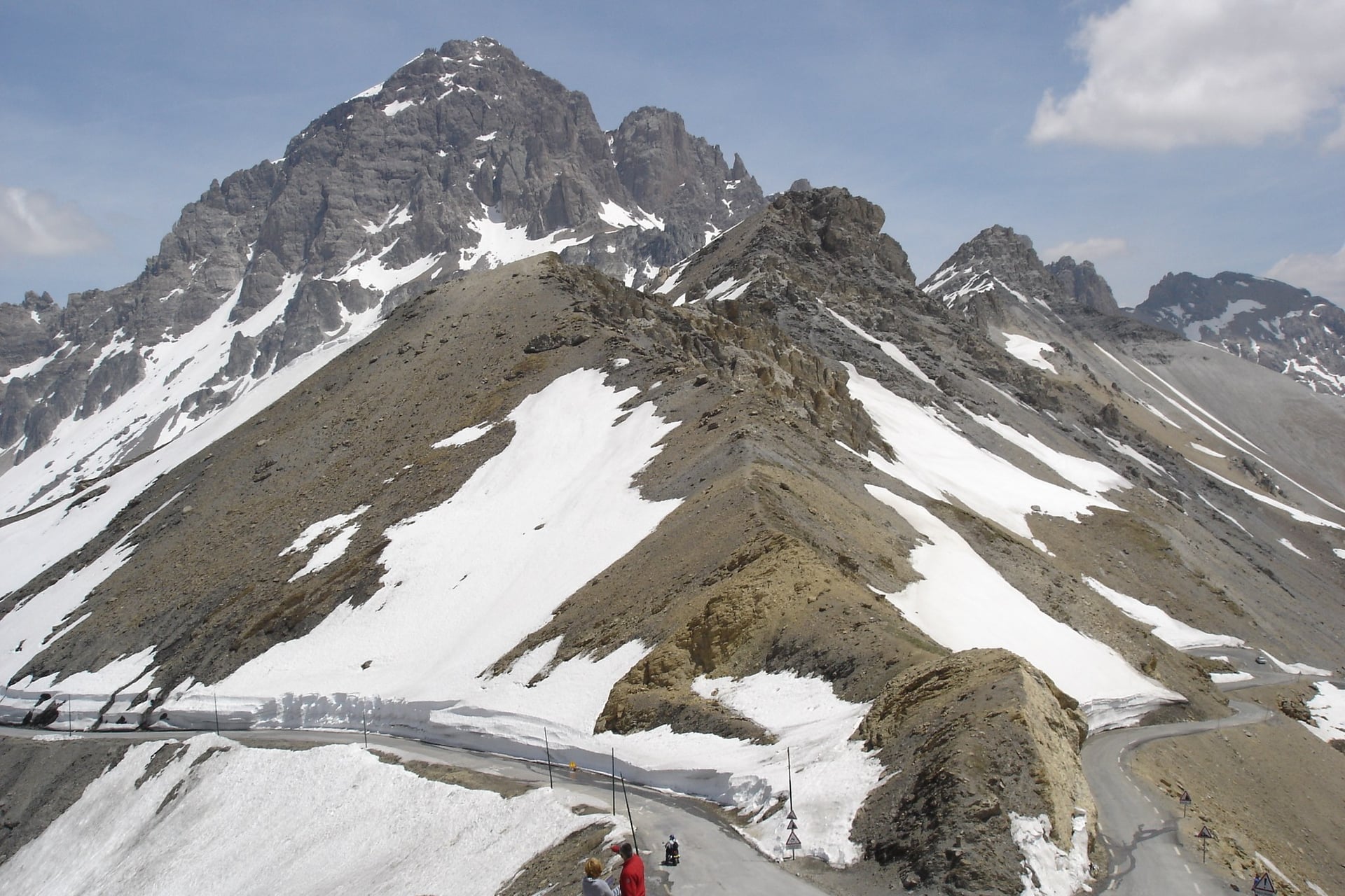
These are the climbs most riders know from the Tour de France. The Route des Grandes Alpes crosses the Iseran, the Galibier at 2,642 m and the Izoard on its way to the Mediterranean, and one of its variants climbs Alpe d'Huez, 14 km at 8% with 21 hairpins.
Gentler riding follows the valleys and lakes. A greenway runs along the west shore of Lake Annecy, and ViaRhôna follows the Rhône for 815 km from Lake Geneva to the Mediterranean, mostly on cycle paths.
Full guide: Cycling in the French Alps
10. The Pyrenees
Signature route: La Vélosud along the foothills, with the Tour de France cols above it
Distance: 650 km from Biarritz to Le Barcarès on the Mediterranean
Elevation gain: 4,700 m on the Vélosud; 1,403 m in 18.9 km for the Tourmalet from Luz-Saint-Sauveur
Highest point: 669 m on the Vélosud; 2,115 m at the Col du Tourmalet
Getting there: Biarritz at the west end, Perpignan at the east end, and Pau and Lourdes stations in between
Where to stay: Pau, Lourdes and Foix on the Vélosud, and Luz-Saint-Sauveur at the foot of the Tourmalet
Best for: the Tourmalet and the other Tour de France cols
Riding season: June to October on the high cols; the foothills from April
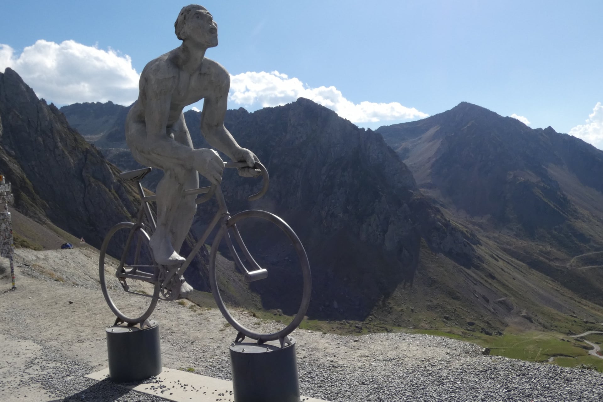
The Tour de France first crossed the Col du Tourmalet in 1910, and the 2,115 m pass is still the centre of Pyrenean cycling. From Luz-Saint-Sauveur the road climbs 18.9 km at 7.4%, and the Aspin, Peyresourde and Aubisque are a day's ride away.
Riders who want the range without the high cols can follow La Vélosud along the foothills. It runs 650 km from Biarritz to Le Barcarès, past Lourdes, with 4,700 m of elevation gain on gentle slopes, and 36% of it is on cycle paths.
France's Long-Distance Cycle Routes at a Glance
France's long routes carry a name and often a European number: La Loire à Vélo is also EuroVelo 6, and green bicycle signs mark them all.
Route | Distance | From and to | On cycle paths | Elevation gain |
La Loire à Vélo (EuroVelo 6) | 900 km signed, 630 km end to end | Nevers to Saint-Brevin-les-Pins | 37% | 783 m |
La Vélodyssée (EuroVelo 1) | 1,300 km | Roscoff to Hendaye | 76% | 3,464 m |
ViaRhôna (EuroVelo 17) | 815 km | Lake Geneva to the Mediterranean | 62% | 1,590 m |
Canal des 2 Mers à Vélo | 750 km | Royan to Sète | 76% | 1,253 m |
La Méditerranée à Vélo (EuroVelo 8) | 850 km | Le Perthus to Menton | 51% | 3,805 m |
La Voie Bleue (V50) | 700 km | Apach to Lyon | 80% | 1,034 m |
Route des Grandes Alpes by bike | 720 km | Thonon-les-Bains to Nice | 1% | nearly 20,000 m |
Ten EuroVelo routes cross France, and beginners do best on the Loire or the Canal des 2 Mers, both flat and signed throughout.
How Hard Is Cycling in France?
Most French cycling is easier than its Tour de France image: the river and canal routes gain less than 2 m for every kilometre ridden.
Hills and Gradients
The effort rises with each kind of region: river and canal routes are almost flat, and wine regions add short climbs between villages. The Tour de Bourgogne gains 1,416 m over 664 km, and the Luberon loop gains 2,670 m in 241 km, about 11 m for every kilometre.
The mountains are a different sport, even where the valley floor is flat. The lakeside road in Annecy is level, but the Col de la Forclaz climbs straight up from the shore of the lake, and Alpe d'Huez gains 1,120 m in 14 km.
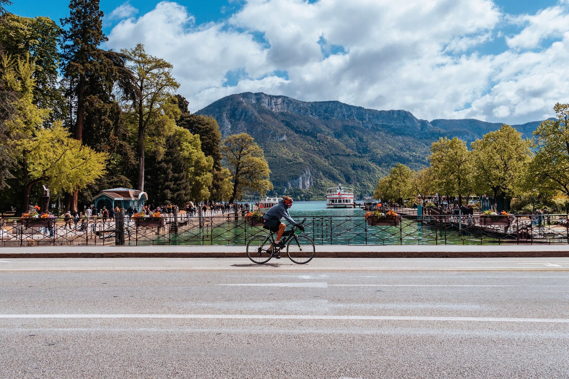
On a loaded bike, low gears matter more than fitness. E-bikes, including electric road bikes, can be hired in Bédoin for Mont Ventoux.
Traffic and Rules of the Road
French drivers must leave at least 1 m when overtaking a bike in town and 1.5 m outside built-up areas, and most signed routes keep to quiet roads and greenways. Several rules differ from the UK and the US, and the national road-safety rules carry fixed fines.
Helmets: compulsory, and fastened, for every rider and passenger under 12; adults are not required to wear one
Hi-vis: a certified reflective vest is compulsory outside built-up areas at night or in poor visibility
The bike: two working brakes, a white or yellow front light, a red rear light, reflectors and a bell audible at 50 m
Earphones: any device worn in or over the ear is banned while riding, as is a handheld phone
Riding two abreast: allowed, but ride in single file at night, on narrow roads and whenever a vehicle overtakes
Pavements: only children under 8 may ride on them
Alcohol: the limit is 0.5 g per litre of blood (0.25 mg per litre of breath), the same as for drivers
An e-bike counts as a bicycle only if the assistance stops at 25 km/h and the motor is 250 W or less. A faster e-bike is a moped, which needs registration, insurance and a helmet.
Waymarking and Navigation
Signed routes carry green and white signs with a bicycle, the route's name or number and, on EuroVelo routes, the EuroVelo logo. La Voie Bleue, for example, is signed V50 in both directions from Sierck-les-Bains to Lyon.
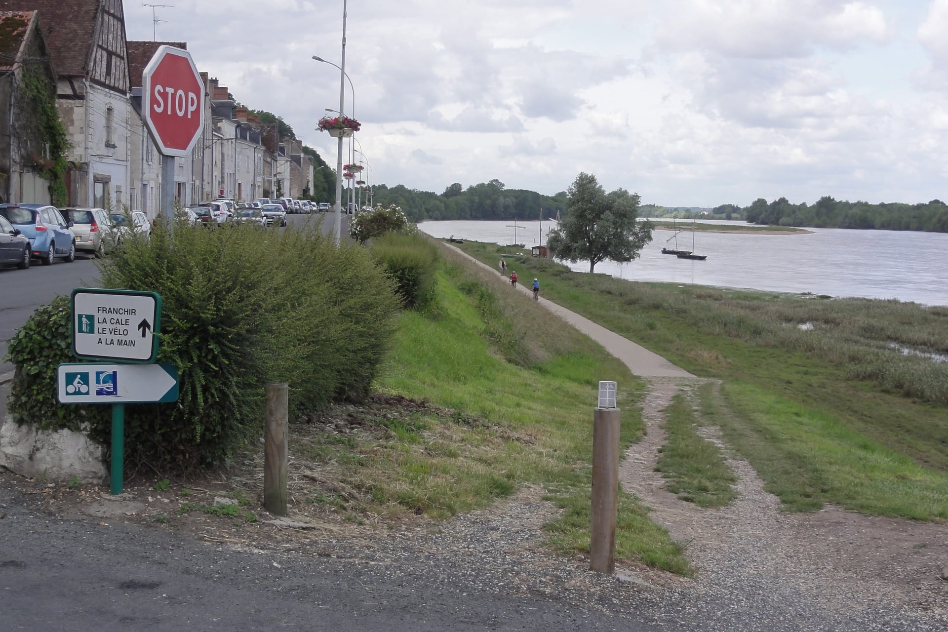
Signs go missing in towns and at some junctions, so carry the route's GPX file on a phone or GPS. France Vélo Tourisme publishes free route maps and GPX files for its signed routes.
Best Time to Cycle in France
The season runs from April to October almost everywhere, and what changes is the heat in the south and the snow on the high passes.
Spring and early autumn suit every region. In July the south is hot enough to plan rides for the morning, with average highs of 32 °C in Avignon and 29 °C in Ajaccio. Tours on the Loire stays near 26 °C.
Average daily high (°C), 2016 to 2025:
Month | Loire (Tours) | Provence (Avignon) | Riviera (Nice) | Corsica (Ajaccio) | Alps (Galibier, 2,642 m) |
April | 16 | 19 | 18 | 19 | -1 |
May | 20 | 23 | 21 | 22 | 3 |
June | 24 | 29 | 26 | 26 | 11 |
July | 26 | 32 | 28 | 29 | 14 |
August | 26 | 31 | 29 | 29 | 13 |
September | 23 | 26 | 25 | 26 | 9 |
October | 18 | 21 | 21 | 23 | 5 |
Snow decides the mountain season, and the highest passes open only in June. In Savoie the Galibier is due to open on the first Friday of June and the Iseran on the second, which closes on the first Monday of November. In 2026 the Iseran opened on 12 June.
For most regions, May, June and September are the best months, with long days and fewer people than in the school holidays.
Know Before You Arrive
The practical side of touring France by bike comes down to three things: the bike on the train, a bed with a safe place for the bike, and food on the road.
Taking Your Bike on French Trains
French trains carry bikes, but the rules change with the type of train. Book the bike space when you buy the ticket, because high-speed trains have few bike hooks and some regions require a bike booking on regional trains in summer.
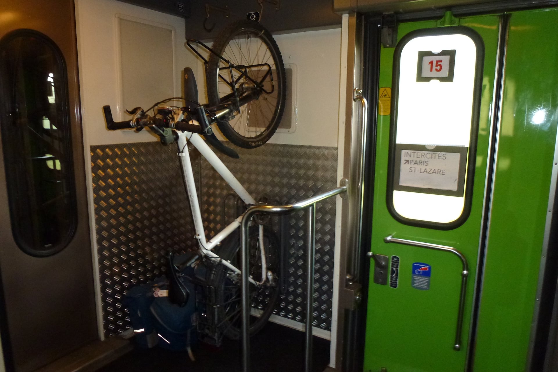
TGV INOUI and Intercités: book a bike space with the ticket on trains that have one; a bike packed in a bag of up to 90 × 130 × 50 cm travels free without a booking
OUIGO: add the bike option when you book; assembled bikes travel only on OUIGO Train Classique, not on the high-speed trains
TER regional trains: assembled bikes ride in the bike spaces, and from May to September 2026 some lines in Auvergne-Rhône-Alpes, Pays de la Loire, Brittany and Provence-Alpes-Côte d'Azur need a bike booking
Eurostar: from London to Paris the bike must be boxed or bagged, and it travels only on set departures, leaving London between 08:01 and 15:31
The main airports for the cycling regions are Paris, Lyon, Nice, Bordeaux, Toulouse, Geneva and Basel-Mulhouse. SNCF Connect's bike rules list each region's current conditions.
Where to Stay: Accueil Vélo
Towns along the signed routes have hotels, chambres d'hôtes (B&Bs), campsites and gîtes, and the Accueil Vélo label marks the places set up for cyclists. More than 9,000 hotels, campsites, bike shops, restaurants and visitor sites carry it.
Every Accueil Vélo place guarantees:
Secure, free bike parking overnight or while you visit
Luggage storage for panniers and bags
Charging for phones, GPS units and, overnight, e-bike batteries
A repair kit for punctures and small faults
Directions from the route to the door, and practical advice when you arrive
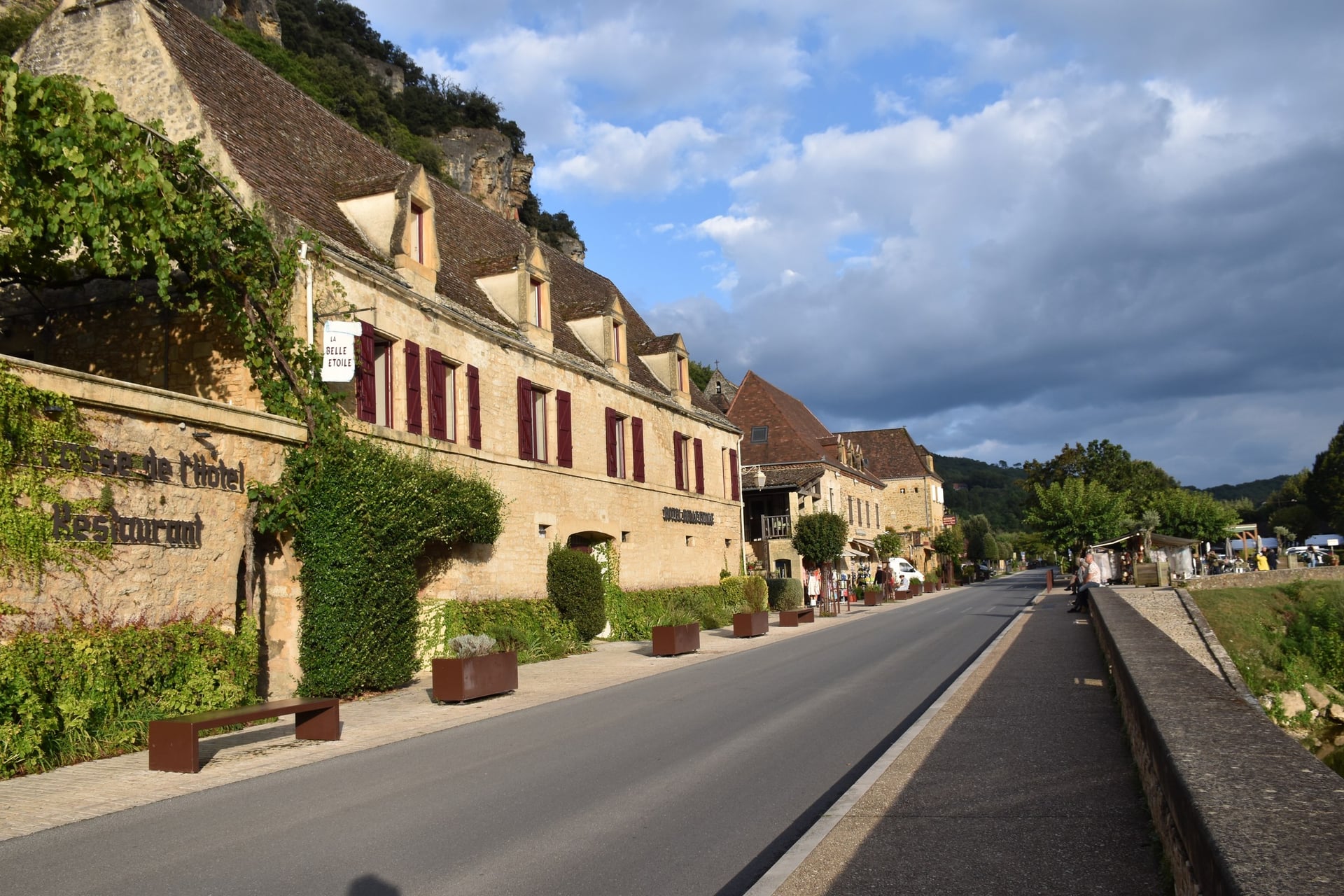
Small villages such as La Roque-Gageac on the Dordogne have hotels in their old stone houses. A chambre d'hôtes has at most five rooms and 15 guests by law, so book small villages early for July and August.
How Much Does It Cost?
Riding in France costs nothing in itself: the signed routes and the cols charge no fees, so the budget goes on beds, meals, trains and bike hire.
Bike on the train: €10 a journey for a bike space on TGV INOUI and Intercités; €5 for a bagged bike or €10 for an assembled one on OUIGO; €1 for a summer TER booking where one is required
Eurostar: £45 or €50 each way for a bagged bike booked more than 48 hours ahead, or £60 or €70 within 48 hours
Bike hire: from €15 to €18 a day for a hybrid bike on the Loire, in Blois and Chambord; road bikes for Mont Ventoux from €45 a day in Bédoin
Château de Chambord: €21 for residents of the European Economic Area and €31 for other visitors
Tourist tax: set by each town and added to the room bill; in a 3-star hotel, €0.50 to €1.70 per person per night in 2026
What to Pack
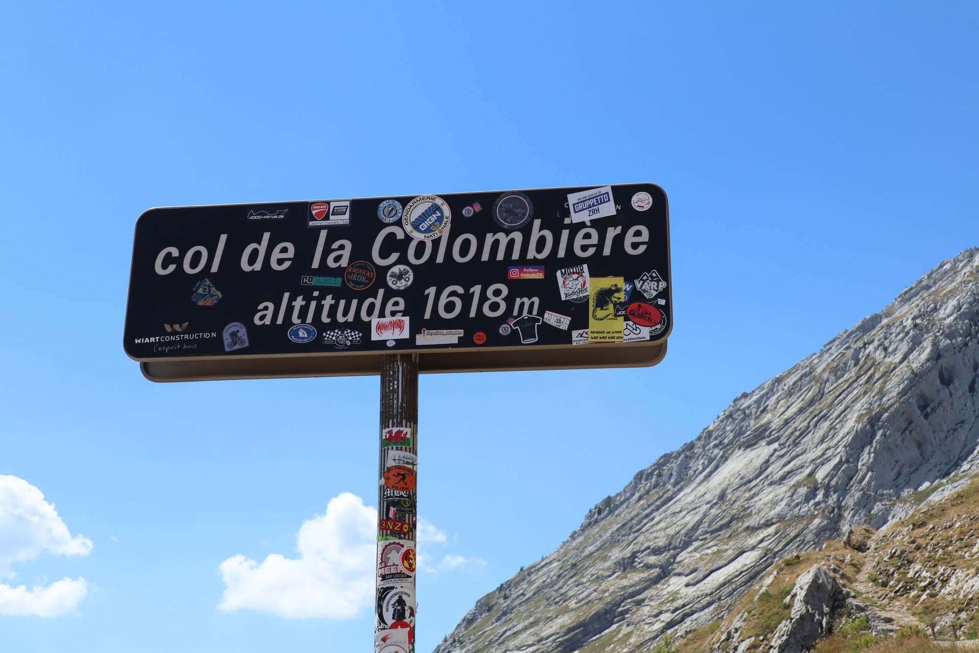
On a col the air cools by about 6.5 °C per 1,000 m. The Col de la Colombière, at 1,618 m, is about 7 °C cooler than the Arve valley below it, and the top of Mont Ventoux about 10 °C cooler than Bédoin.
For any ride in France:
Helmet, two 750 ml water bottles and a pump
Two spare tubes, tyre levers and a multi-tool, because bike shops are far apart outside towns
Lights, reflectors and a bell, which French law requires
A reflective vest for riding outside towns at night or in poor light
Rain jacket and arm warmers for cool mornings
Phone with the route's GPX file and a power bank
For the mountains and the south:
Windproof gilet and full-finger gloves for long descents from the cols
Low gears, which matter more than a light bike on the long climbs
Sun cream and electrolyte tablets for July and August in Provence and Corsica
Water, Shops and Lunch Hours
Food and water need a little planning outside towns. Village shops and many restaurants close for lunch, usually from about noon until the middle of the afternoon, and many shops shut on Sunday afternoons and Mondays. Restaurants usually serve lunch from noon until about 14:00, so arrive by 13:30.
Tap water in France is safe to drink, and most village cemeteries have a tap by the gate. Avoid any tap marked "eau non potable", which means the water is not for drinking.
Flat, Rolling or Mountains: Choosing Your First Week
The best first week in France depends on the daily elevation gain more than on the scenery. A river route is the easiest start, wine country adds short climbs, and the Alpine cols need training for days of 1,600 m or more.
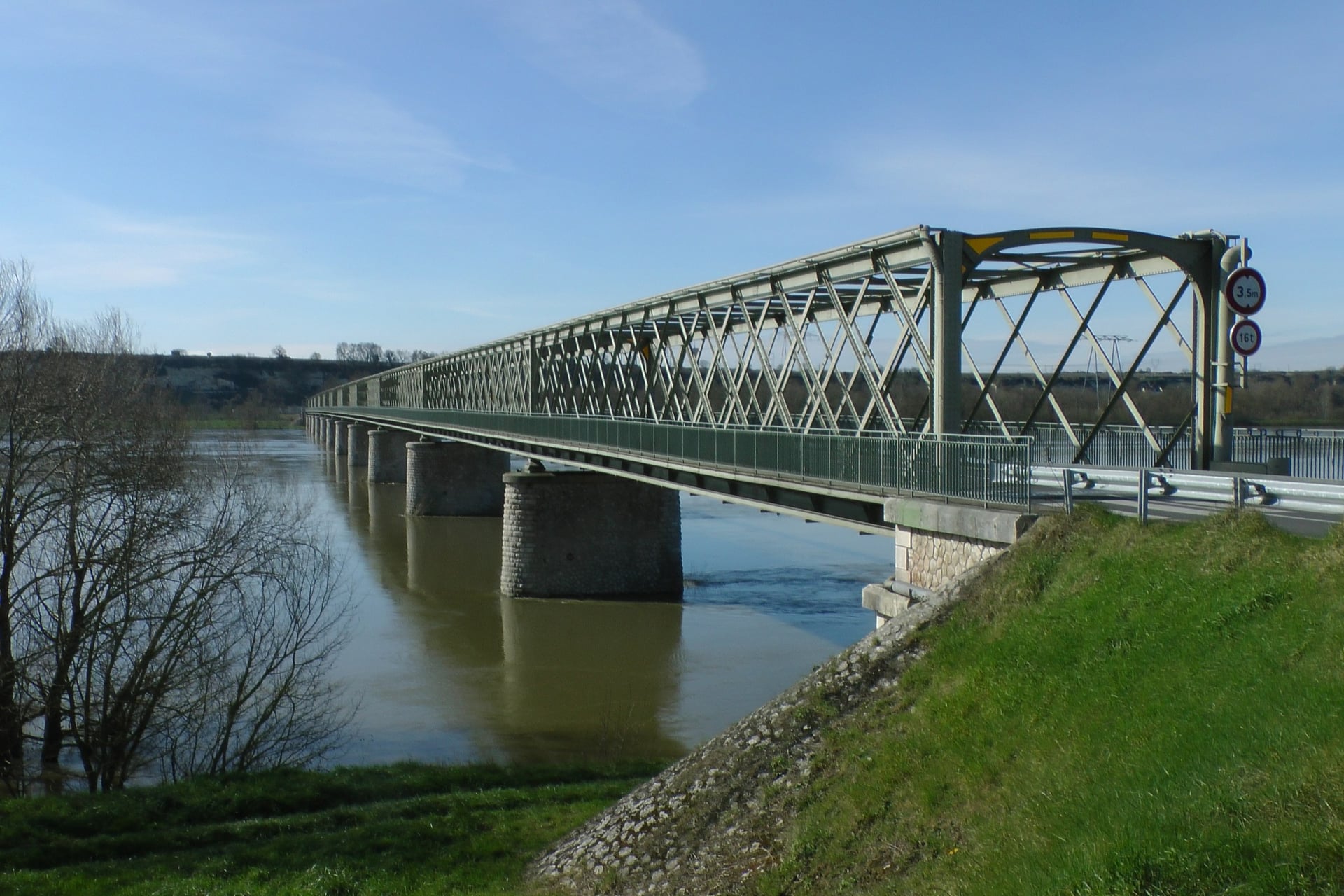
A week also means a new bed most nights and bags to move between towns. Our self-guided tours book the hotels and move the luggage for you, and three of them match the three kinds of riding.
River: Loire Valley Cycling Holidays, 6 days / 4 riding days from a base in Montsoreau, 20 to 75 km a day and 730 m of elevation gain in all, April to October
Vineyards: Vineyards of Burgundy Cycling Holidays, 7 days / 5 riding days on a loop from Beaune, 41 to 59 km a day and 1,360 m in all, April to September
Mountains: French Alps Cycling Tour, 7 days / 5 riding days from Annecy to Grenoble, 62 to 92 km a day with 1,632 to 2,329 m of elevation gain each day, May to October
Each tour includes hotels with breakfast, daily luggage transfers, a route booklet, a GPS app and support while you ride. Ask us about dates for next season. The full list of our tours in France has more regions.
A flat first week on the Loire is a good way to learn how a French cycling holiday works, before you try the vineyards of Burgundy or the cols of the Alps.
Frequently Asked Questions



Plan with a cycling expert
Free advice from a team that knows these routes inside out - real people, not a bot

Hassle-Free
We take care of route planning, accommodations, luggage transfers, and all logistics, so you can focus purely on enjoying your ride.

Tried & Tested Adventures
Our cycling routes are hand-picked & tested, to ensure breathtaking landscapes, smooth roads, and maximum safety - giving you the perfect ride every day.

Unbeatable Support
Our 24/7 customer support is where we show our passion, ensuring your cycling holiday runs smoothly and your well-being is always our top priority.

Book with Confidence
We are a financially protected company, fully bonded and insured, keeping your money safe and allowing you to travel with confidence.