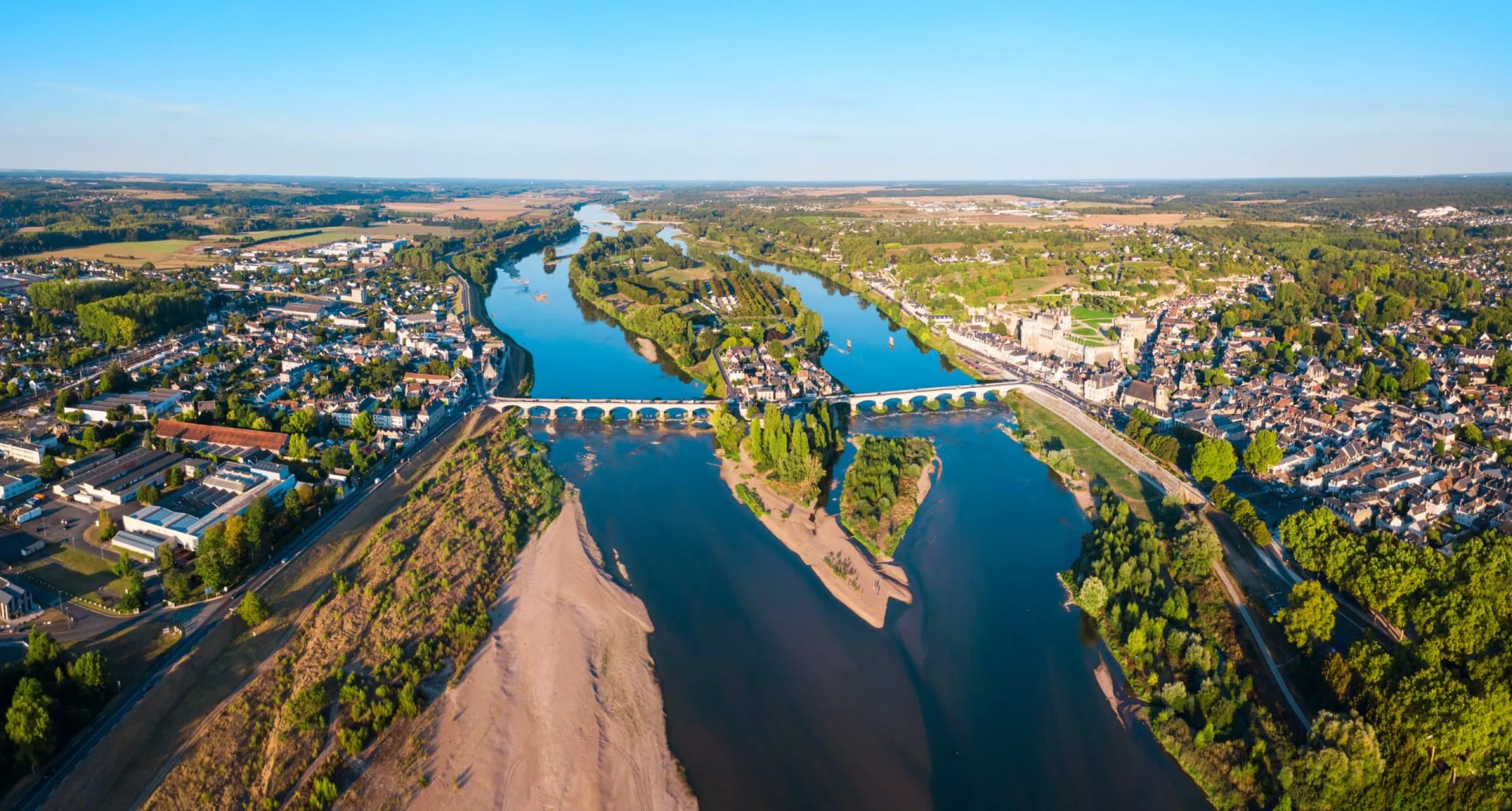
Loire Valley Cycle Route: La Loire à Vélo Stage by Stage
La Loire à Vélo from Cuffy to the Atlantic in seven parts: 630 km of flat, signed riding past the châteaux, with distances, stations and the best direction.
Quick links
Don't want to read all this?
We've planned 800+ cycling trips. Send your dates, fitness and group size — we'll map the route and book every night.


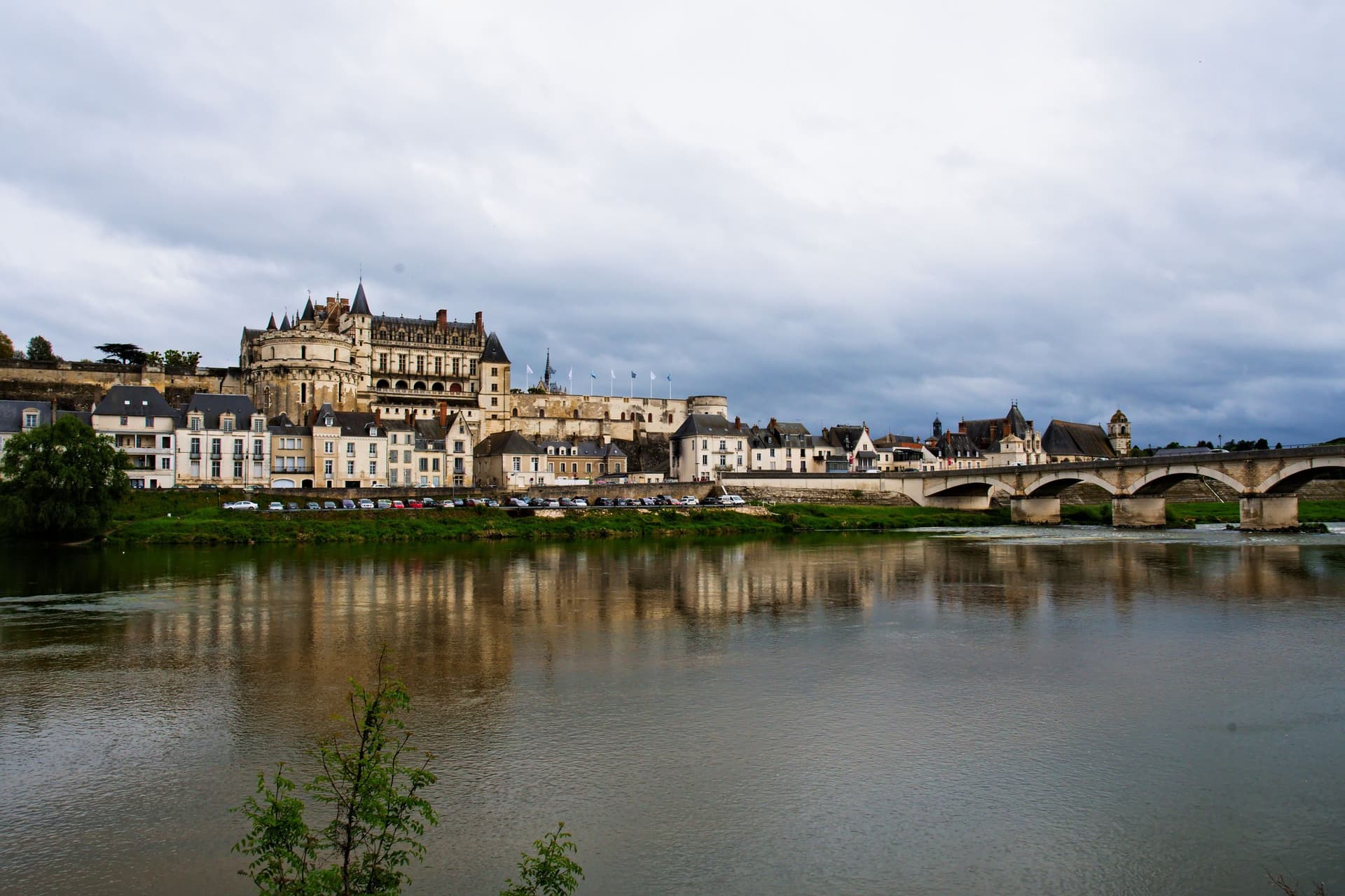
The Loire Valley cycle route follows France's longest river from Nevers to the Atlantic, past the vineyards of Sancerre and Vouvray. You ride on levee tops and towpaths above sandbanks and islands, and most days end below a château. West of Saumur, houses and wine cellars are cut into the white tufa cliffs.
The signed route is La Loire à Vélo, the western end of EuroVelo 6. It runs about 630 km from Cuffy, near Nevers, to Saint-Brevin-les-Pins, and it climbs only 783 m from end to end.
It is the flattest of the long routes in our guide to cycling in France. A railway follows the river most of the way, so you can ride one part and take the train back.
What Is the Loire Valley Cycle Route?
La Loire à Vélo is a signed cycle route along the river, developed by the Centre-Val de Loire and Pays de la Loire regions. Its first section, Tours to Angers, opened in 2005, and the whole route opened in 2012.
The main line runs about 630 km from Cuffy to Saint-Brevin-les-Pins. Another 270 km of loops and variants bring the signed network to 900 km. France Vélo Tourisme splits the line into 37 stages of 8 to 30 km, and every stage is signed in both directions.
The official start at Cuffy is 13 km from Nevers station along EuroVelo 6, which crosses the Allier on the Guétin canal bridge. Between Sully-sur-Loire and Chalonnes-sur-Loire, 280 km of the valley has been a UNESCO World Heritage Site since 2000. Each year about 1.9 million cyclists ride part of the route.
The Route Stage by Stage
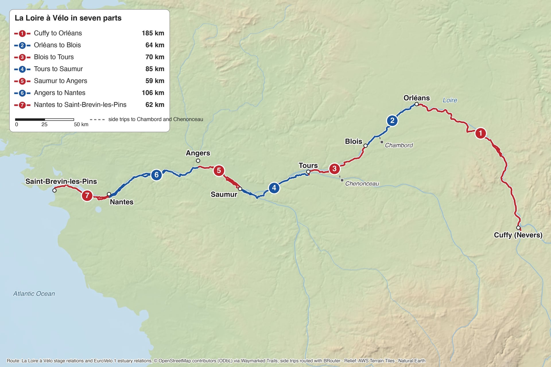
The river changes as it runs west: vineyards and wild sandbanks upstream, then château towns, tufa cliffs and Anjou wine slopes, and finally a tidal estuary. The seven parts follow France Vélo Tourisme's sections and stage numbers from east to west. Every part town has a station except Cuffy and Saint-Brevin-les-Pins.
Section | Distance | Stages | On the way |
Cuffy to Orléans | 185 km | 2 to 12 | Sancerre vineyards, Briare canal bridge, Gien, Sully-sur-Loire |
Orléans to Blois | 64 km | 13 to 16 | Meung-sur-Loire, Beaugency, branch to Chambord |
Blois to Tours | 70 km | 17 to 20 | Chaumont-sur-Loire, Amboise, side trip to Chenonceau |
Tours to Saumur | 85 km | 21 to 24 | Villandry, Ussé, Candes-Saint-Martin, Montsoreau |
Saumur to Angers | 59 km | 25 to 27 | Troglodyte villages, Cunault, Angers château |
Angers to Nantes | 106 km | 29 to 34 | Béhuard, Chalonnes-sur-Loire, Saint-Florent-le-Vieil, Champtoceaux |
Nantes to Saint-Brevin-les-Pins | 62 km | 35 to 37 | Le Pellerin, Canal de la Martinière, Paimboeuf |
The distances add up France Vélo Tourisme's stage lengths, 631 km in all. Stage 1, from Nevers station to Cuffy, adds 13 km, and stage 28 is a 15 km bypass of central Angers. In each part, the figure after a town is its distance from the start of that part.
Part 1: Cuffy to Orléans
Distance: 185 km, or 198 km from Nevers station
Stages: 2 to 12, from 11 to 29 km
Surface: mostly greenway beside the Canal latéral à la Loire and on levees, with some hilly roads on the 40 km between Briare and Sully-sur-Loire
Where to sleep: La Charité-sur-Loire 27 km, Saint-Satur below Sancerre 51 km, Briare 94 km, Gien 106 km, Sully-sur-Loire 134 km
Stations: Nevers, La Charité-sur-Loire, Cosne-sur-Loire, Briare and Gien on the line to Paris, then Orléans
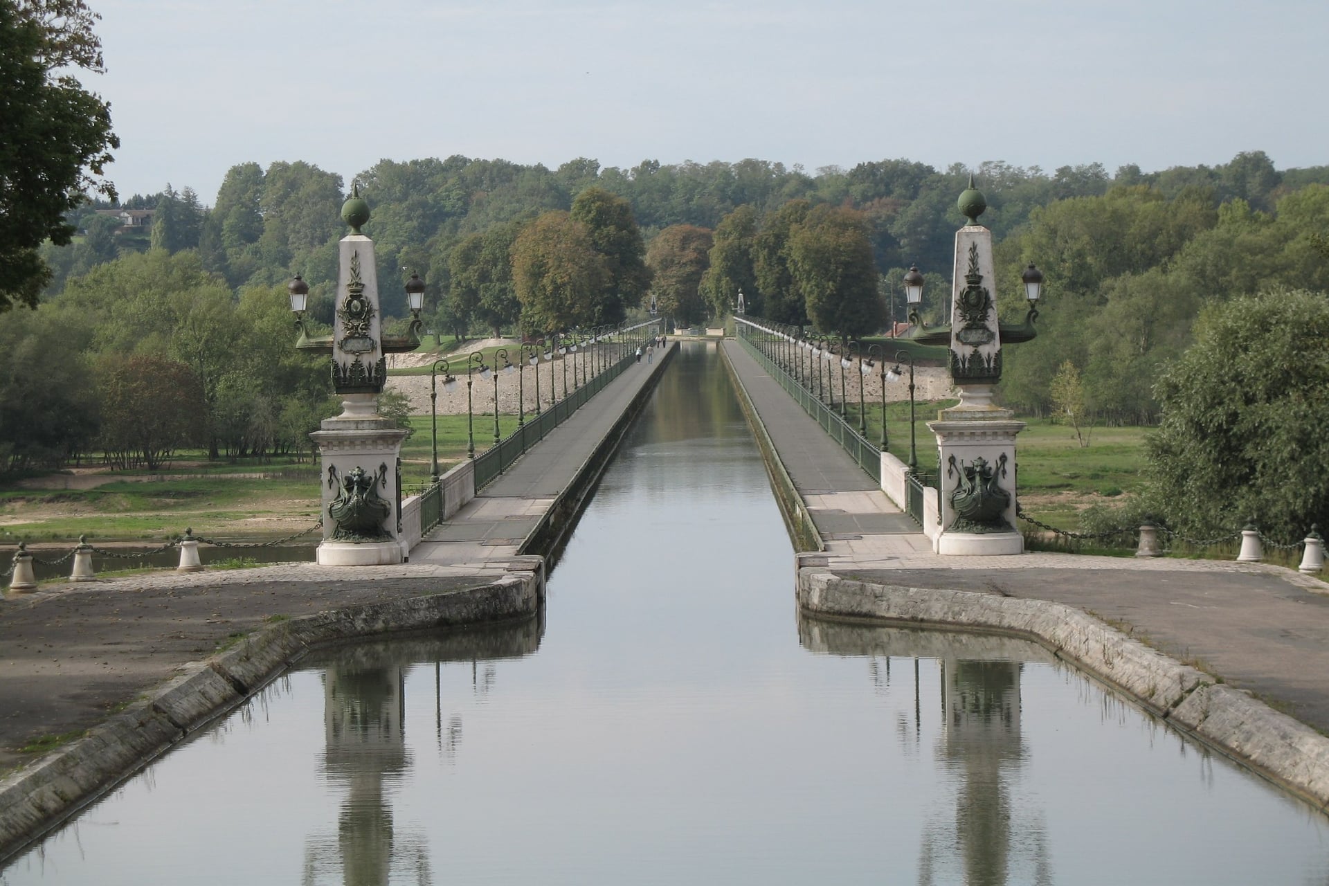
The upper Loire is wine country and wild river. From Cuffy the route follows the canal and the levees past La Charité-sur-Loire and the Pouilly-Fumé vineyards. Sancerre sits on its hill, a short, steep climb above Saint-Satur.
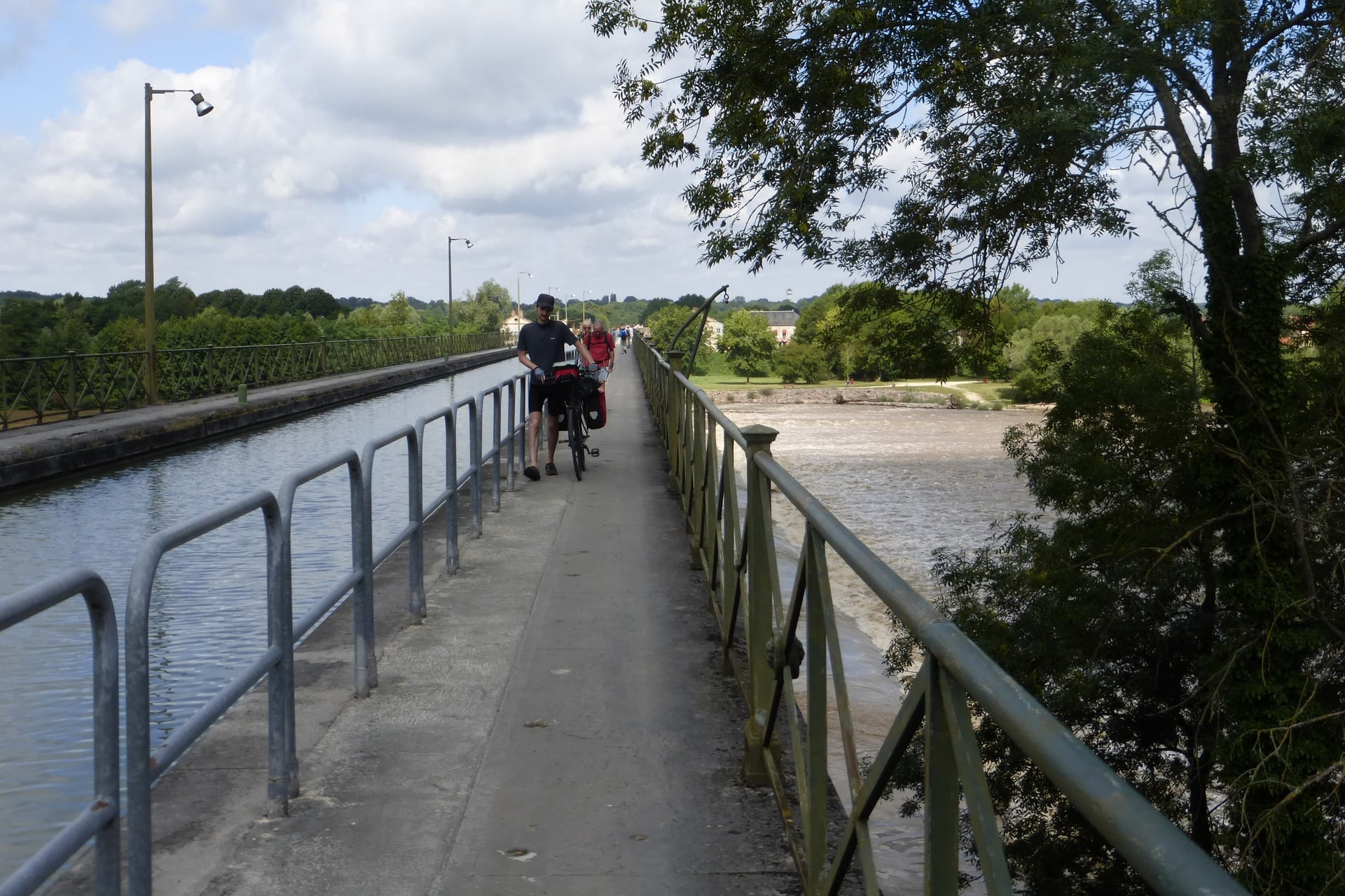
At Briare the canal crosses the Loire on a 662 m bridge, the largest metal canal bridge in France, and the route crosses the river on its towpath. Gien follows after 12 km, and the moated Château de Sully, 28 km further on, marks the start of the UNESCO stretch.
Villages here are smaller and farther apart than downstream, so carry food for the day. Upstream of Nevers, EuroVelo 6 continues to Decize, where the Canal du Nivernais route in our Burgundy guide ends.
Part 2: Orléans to Blois
Distance: 64 km
Stages: 13 to 16, from 8 to 21 km
Surface: levee paths and a riverside cycle path from Tavers to Avaray, then quiet roads into Blois
Where to sleep: Saint-Hilaire-Saint-Mesmin 8 km, Beaugency 29 km, Muides-sur-Loire 45 km, Blois 64 km
Stations: Orléans, Meung-sur-Loire, Beaugency, Mer and Blois-Chambord
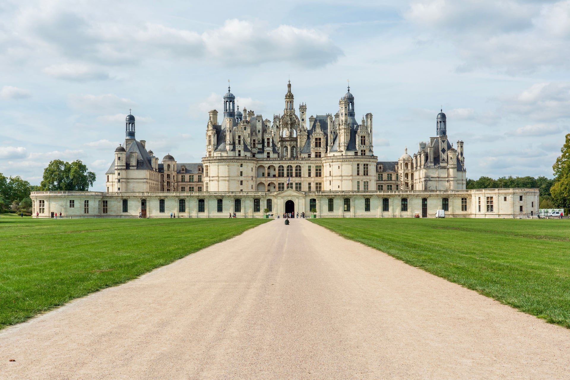
West of Orléans the route stays close to the river past the Loiret confluence and the levee at Saint-Hilaire-Saint-Mesmin. Meung-sur-Loire has its castle and Beaugency its long medieval bridge, and both make good first-night stops within 30 km.
At Saint-Dyé-sur-Loire, once Chambord's river port, a signed branch runs about 7 km through the forest to Chambord. The largest château in the Loire Valley has 426 rooms and a walled park of 5,440 hectares, and the branch makes it an easy half day from the river.
Around Blois, the Châteaux à Vélo network adds 500 km of signed routes. Its loops of 10 to 45 km link Chambord, Cheverny, Blois and Chaumont-sur-Loire.
Part 3: Blois to Tours
Distance: 70 km
Stages: 17 to 20, from 12 to 23 km
Surface: quiet roads and vineyard lanes to Chaumont-sur-Loire and Amboise, then 85% greenway on the 27 km from Amboise to Tours
Where to sleep: Chaumont-sur-Loire 20 km, Amboise 43 km, Montlouis-sur-Loire 58 km, Tours 70 km
Stations: Blois-Chambord, Onzain-Chaumont-sur-Loire, Amboise, Saint-Pierre-des-Corps and Tours
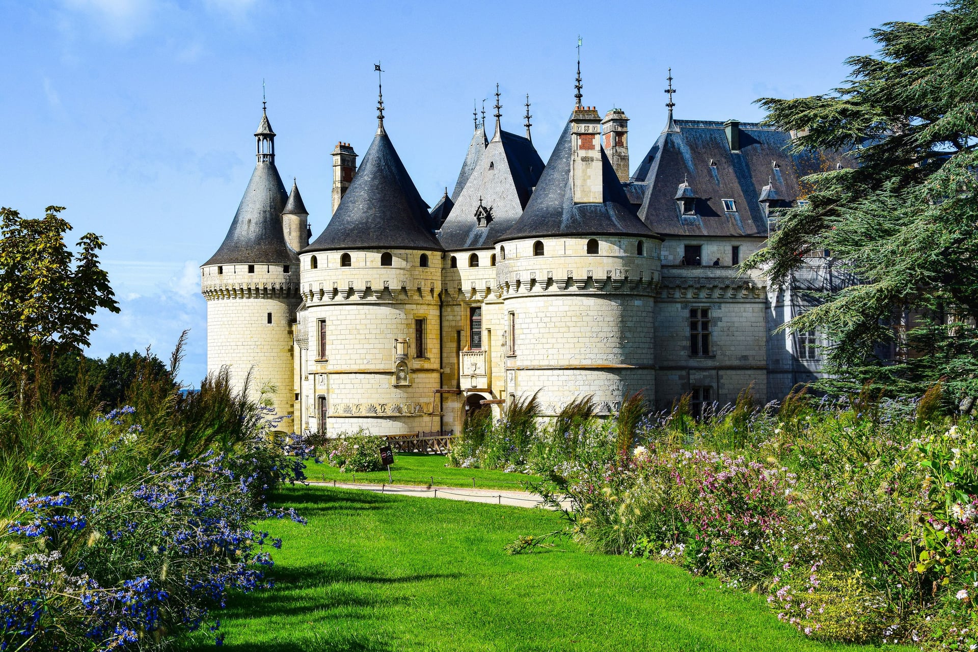
This is the best-known stretch of château country. The route leaves Blois on the south bank and reaches Chaumont-sur-Loire after 20 km. Its estate holds the International Garden Festival from 22 April to 1 November 2026.
Amboise, 23 km further on, has the royal château above the river and the Clos Lucé, where Leonardo da Vinci spent his last years. From there the last 27 km into Tours run mostly on greenway, past the Montlouis vineyards.
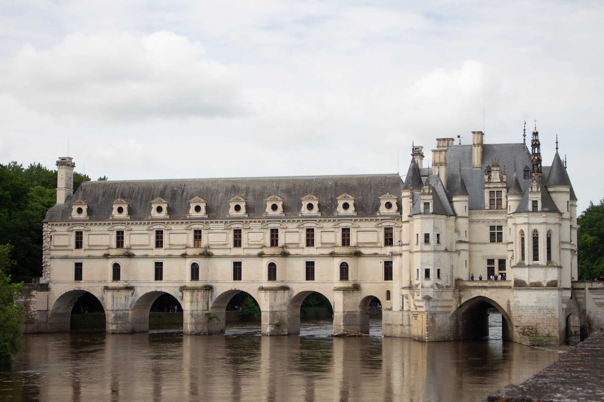
Chenonceau stands on the Cher, about 12 km south of Amboise as the crow flies. Signed loop 47 links it with Amboise: about 20 km each way, or a 45 km circuit with 250 m of climbing.
Part 4: Tours to Saumur
Distance: 85 km
Stages: 21 to 24, from 17 to 25 km
Surface: cycle paths beside the Cher to Villandry, levee roads to Ussé, then greenways and quiet roads by the river
Where to sleep: Villandry 22 km, Rigny-Ussé 43 km, Candes-Saint-Martin 68 km, Montsoreau 70 km, Saumur 85 km
Stations: Tours, Langeais, Port-Boulet and Saumur
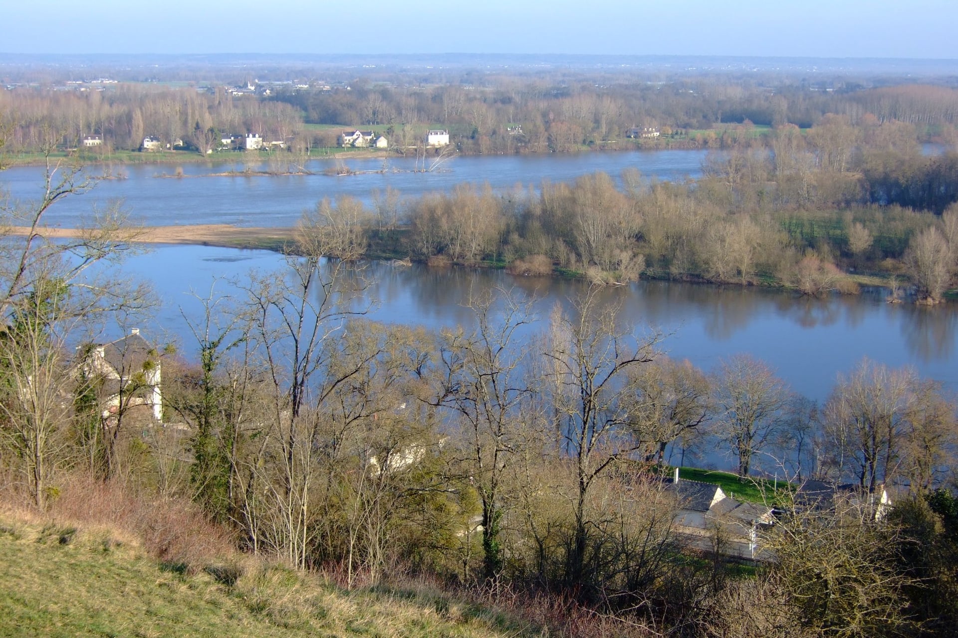
Villandry and its terraced Renaissance gardens come first, 22 km from Tours along the Cher. The route then rides the levee beside the Loire to Ussé, the château said to have inspired Perrault's Sleeping Beauty.
At Candes-Saint-Martin the Vienne joins the Loire, and the view over the confluence is one of the widest on the route. Montsoreau and its château stand 2 km downstream. For the last 17 km into Saumur, choose the riverside greenway or a hillier vineyard road.
Two side trips leave this corner. One follows the Vienne up to Chinon and its royal fortress, and the other runs about 5 km south to Fontevraud Abbey, where Henry II and Eleanor of Aquitaine are buried.
Part 5: Saumur to Angers
Distance: 59 km
Stages: 25 to 27, from 13 to 30 km
Surface: quiet roads along the south bank, then levees and farm roads on the north bank through the Authion valley
Where to sleep: Saint-Rémy-la-Varenne 30 km, La Daguenière 43 km, Angers 59 km
Stations: Saumur and Angers Saint-Laud
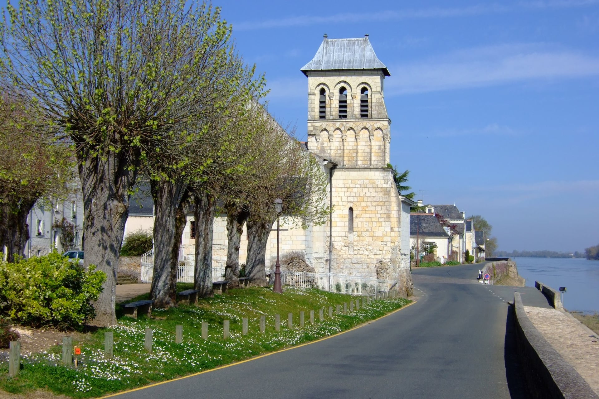
Below Saumur the route keeps to the south bank, where houses, wine cellars and mushroom farms are cut into the soft white tufa. The 30 km stage to Saint-Rémy-la-Varenne, past the Romanesque church at Cunault and through Le Thoureil, is the longest of the 37 official stages.
The route then crosses to the north bank and follows the levees through the Authion valley's market gardens to La Daguenière. There it splits: one branch enters Angers past the old slate quarries of Trélazé, and stage 28 skips the city on the way to Bouchemaine.
Angers château, with 17 towers, holds the Apocalypse Tapestry, about 100 m long and on UNESCO's Memory of the World register since 2023. La Vélobuissonnière from Alençon ends at Saumur. La Vélo Francette, from Normandy to La Rochelle, shares the river from Angers to Saumur.
Part 6: Angers to Nantes
Distance: 106 km
Stages: 29 to 34, from 9 to 24 km
Surface: park paths beside the Maine out of Angers, then quiet levee roads and greenways
Where to sleep: Bouchemaine 9 km, Chalonnes-sur-Loire 29 km, Saint-Florent-le-Vieil 52 km, Champtoceaux 76 km, Nantes 106 km
Stations: Angers Saint-Laud, Chalonnes-sur-Loire, Ancenis and Nantes
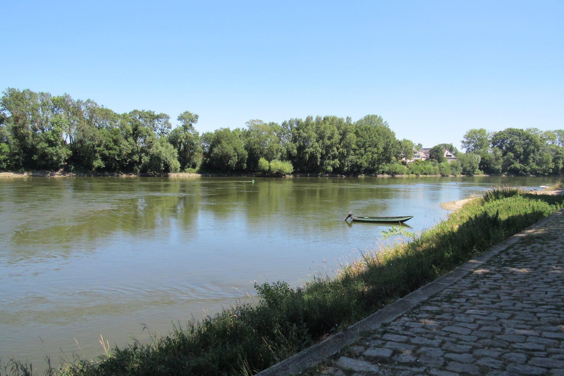
Out of Angers the route follows the Maine through parks to its confluence with the Loire at Bouchemaine, 9 km away. It passes the Savennières vineyards and Béhuard, a village on an island in the river, then crosses to Chalonnes-sur-Loire, where the UNESCO stretch ends after 280 km.
West of Chalonnes the levee roads look across islands to the Coteaux du Layon vineyards and the hilltop villages of Montjean-sur-Loire and Saint-Florent-le-Vieil. Champtoceaux, 76 km from Angers, stands on a bluff above the river at the edge of Anjou.
From Ancenis to Nantes, France Vélo Tourisme recommends the north bank, mostly on cycle paths. Nantes, the largest city on the whole route, ends this part at the Château des ducs de Bretagne.
Part 7: Nantes to Saint-Brevin-les-Pins
Distance: 62 km
Stages: 35 to 37, from 12 to 26 km
Surface: quiet roads and cycle paths along the south bank of the estuary and the Canal de la Martinière
Where to sleep: Le Pellerin 24 km, Paimboeuf 50 km, Saint-Brevin-les-Pins 62 km
Stations: Nantes; none on the south bank west of the city
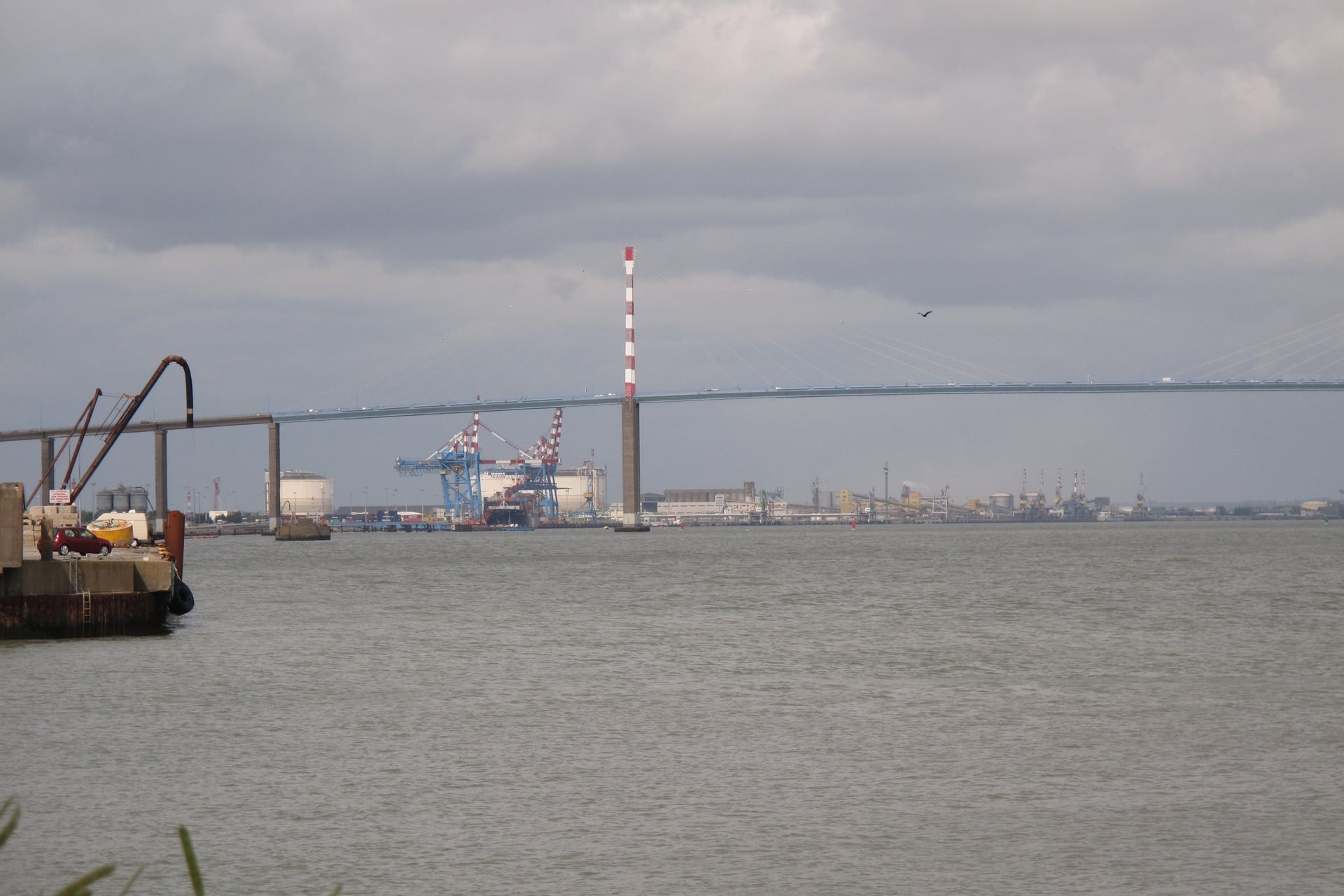
Beyond Nantes the Loire becomes a tidal estuary, and the route stays on its south bank. The 24 km stage to Le Pellerin passes open-air artworks, and the next 26 km follow the quiet Canal de la Martinière through marshes to Paimboeuf.
The last 12 km run from Paimboeuf to Saint-Brevin-les-Pins, a seaside resort where La Loire à Vélo meets La Vélodyssée on the Atlantic coast. Saint-Brevin has no station, and cyclists are advised not to ride the Saint-Nazaire bridge. Plan the shuttle or the bus listed under Getting There and Back.
How Hard Is the Route?
The route suits beginners. France Vélo Tourisme classes it as a first-timer's route because the roads it shares carry very little traffic, and its climbs are short.
Gradient, Wind and Surface
Over 630 km the route climbs only 783 m, and its highest point is 185 m. The few real slopes come between Briare and Sully-sur-Loire, around Chaumont-sur-Loire and on the vineyard option into Saumur.
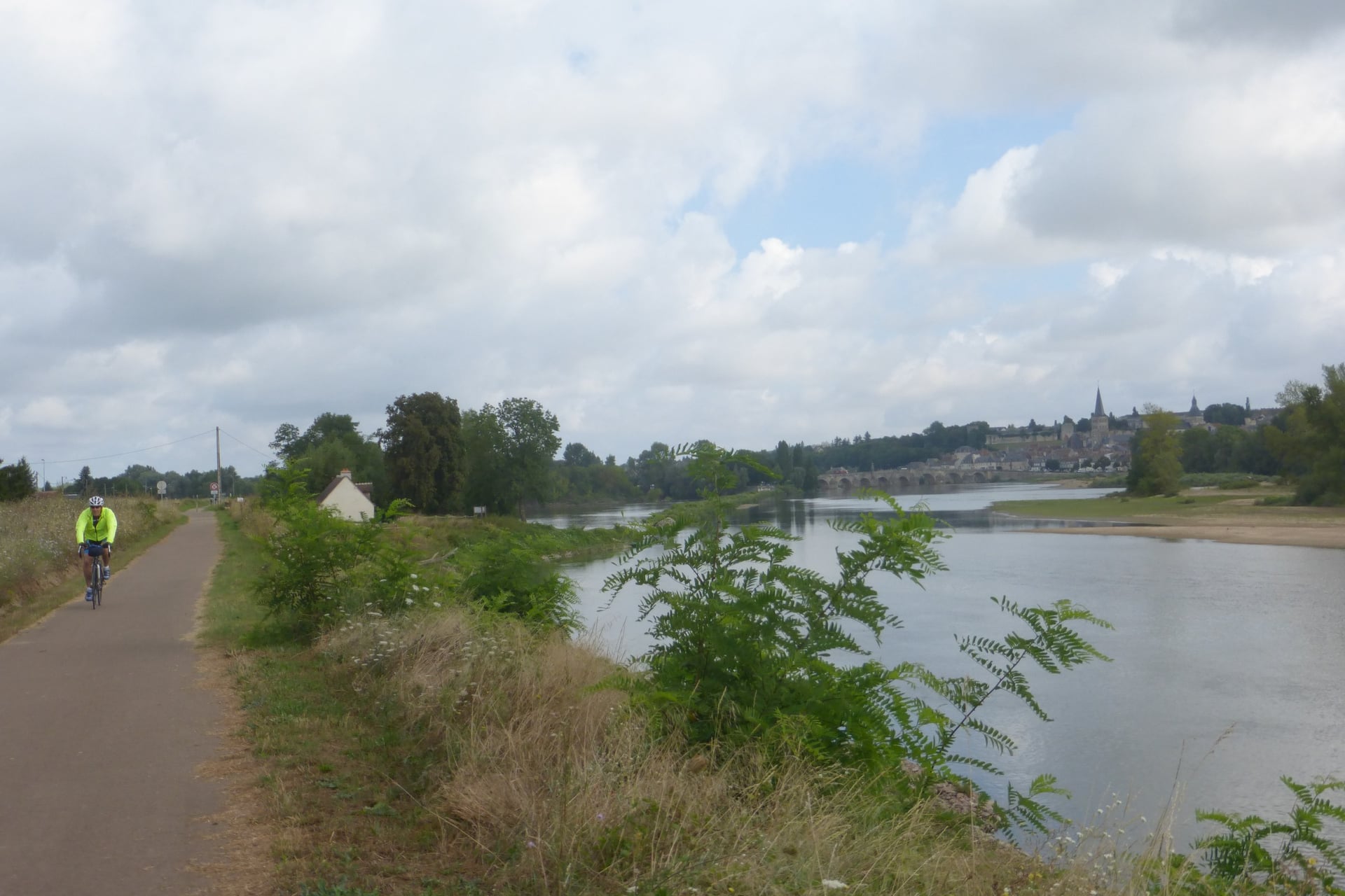
On long flat stretches such as the greenway from La Chapelle-Montlinard to Argenvières, a headwind slows you more than any climb on the route. The prevailing wind blows from the west.
About 62% of the line uses shared roads, mostly quiet lanes and levee tops, and 37% is cycle path. France Vélo Tourisme rates 86% of the surface as smooth and 5% as rough, mostly gravel by the river, so a hybrid or touring bike suits the whole route.
Signs and Navigation
Every stage is signed in both directions with the Loire à Vélo logo and the EuroVelo 6 number. Most riders follow the signs without a map.
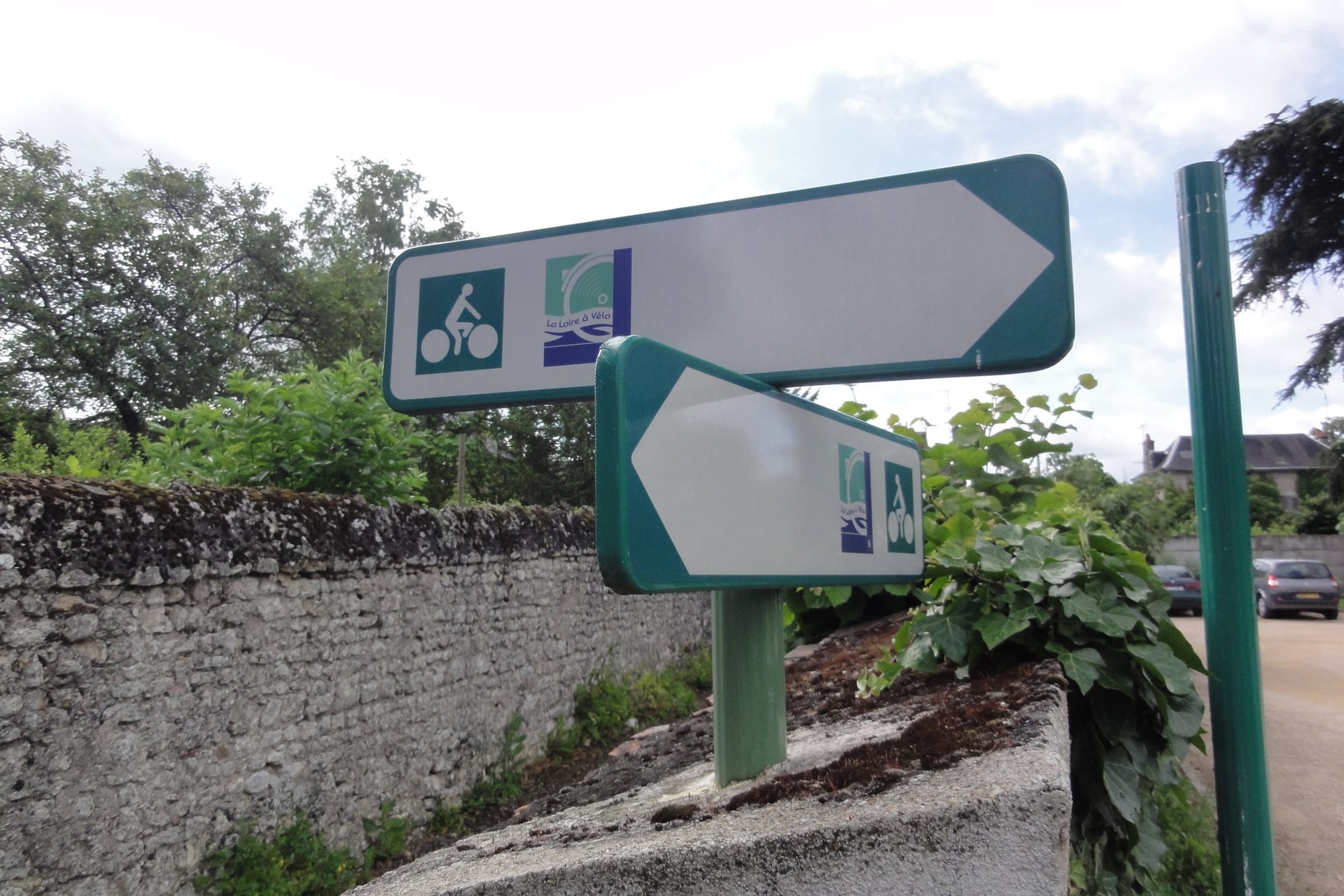
At junctions such as the one at Saint-Hilaire-Saint-Mesmin, the green and white signs point both ways along the river. Where loops leave the main line, and in the centres of Orléans, Tours, Angers and Nantes, a GPX track on your phone saves wrong turns.
The official site has free GPX tracks for every stage and an English route map to download and print.
Cycling the Loire With Children
Children manage the Loire well when the days are short. The regional tourist board suggests stages of 5 to 20 km, and helmets are compulsory for riders under 12, child-seat passengers included.
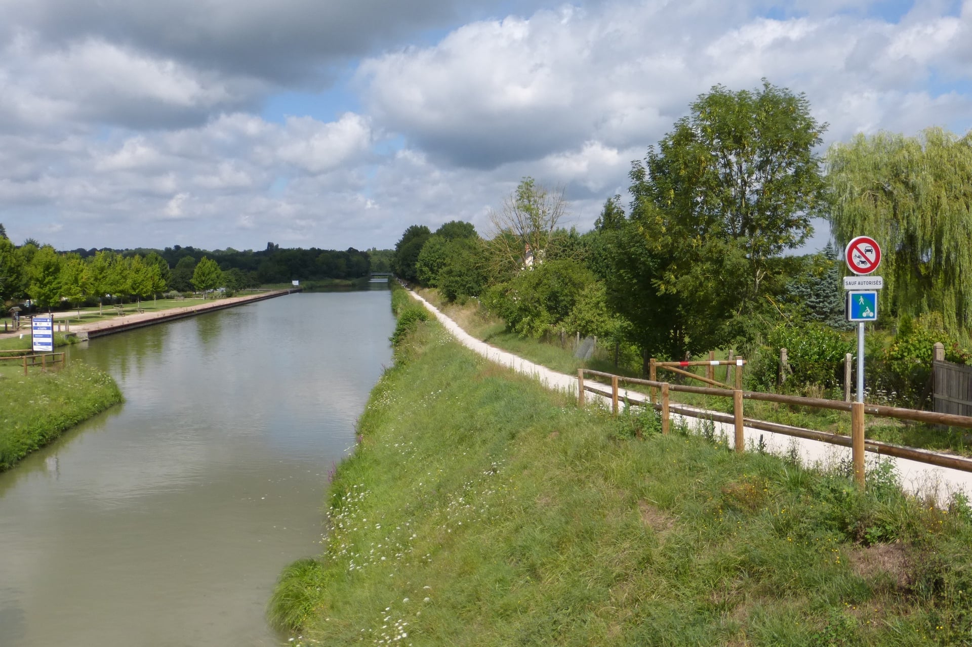
For a first family trip, France Vélo Tourisme picks the sections that run mostly on cycle paths:
Nevers to Saint-Satur: the canal greenway through Cuffy, below Sancerre
Belleville-sur-Loire to Briare: canal and riverside paths to the canal bridge
Candé-sur-Beuvron to Chaumont-sur-Loire: a short stretch south-west of Blois
Montlouis-sur-Loire to Tours and Villandry: the riverside greenway through Tours
La Daguenière to Bouchemaine and Angers: levees and park paths by the Maine
Ancenis to Nantes: the north bank, mostly on cycle paths
Paimboeuf to Saint-Brevin-les-Pins: the last 12 km, to the seaside
A one-way ride with a train back keeps the day short. The Train Loire à Vélo stops in five château towns: Blois, Amboise, Tours, Saumur and Angers.
How Long It Takes and Which Way to Ride
The gradient barely changes from one end to the other, so planning comes down to your daily distance and the wind.
How Many Days
A fit rider covers the whole line in about a week. Most riders choose one or two parts and spend four to six days on them. Beginners manage 30 to 40 km a day, and with château visits 25 to 35 km is more realistic.
Pace | Daily distance | Whole line, about 630 km | Blois to Saumur, 155 km |
Fit rider, few stops | 80 to 100 km | 7 to 8 days | 2 days |
Touring with château visits | 40 to 60 km | 11 to 16 days | 3 to 4 days |
Beginners | 30 to 40 km | 16 to 21 days | 4 to 6 days |
Plan rest days in the château towns, because Blois, Amboise and Saumur each need more than an afternoon.
Which Direction to Ride
The route is signed both ways, and the gradient is too slight to decide it. France Vélo Tourisme advises beginners to start at the Atlantic and ride east, with the prevailing westerly wind behind them.
Open-Meteo data for Tours from 2016 to 2025 back that up in summer. The dominant wind blew from between south-west and north-west on 57% of July days, but on only 37% of April days, so a west-to-east ride gains most from the wind in summer.
Riding downstream gives a finish by the sea at Saint-Brevin-les-Pins. Saint-Nazaire station, across the estuary, has trains back to Nantes and Paris.
When to Cycle the Loire
The route can be ridden all year, but the heat, the rain and the opening dates of gardens and campsites change by season. Figures are Open-Meteo averages for Tours from 2016 to 2025.
April and May: highs of 16 °C and 20 °C, with 10 and 13 rain days; the Chaumont-sur-Loire garden festival opens on 22 April
June: 24 °C, 10 rain days and the longest days; Saumur holds Anjou Vélo Vintage, a festival of old bikes, in late June
July and August: 26 °C on average, with about 5 days above 30 °C in July and 7 in August; 15 August is a public holiday
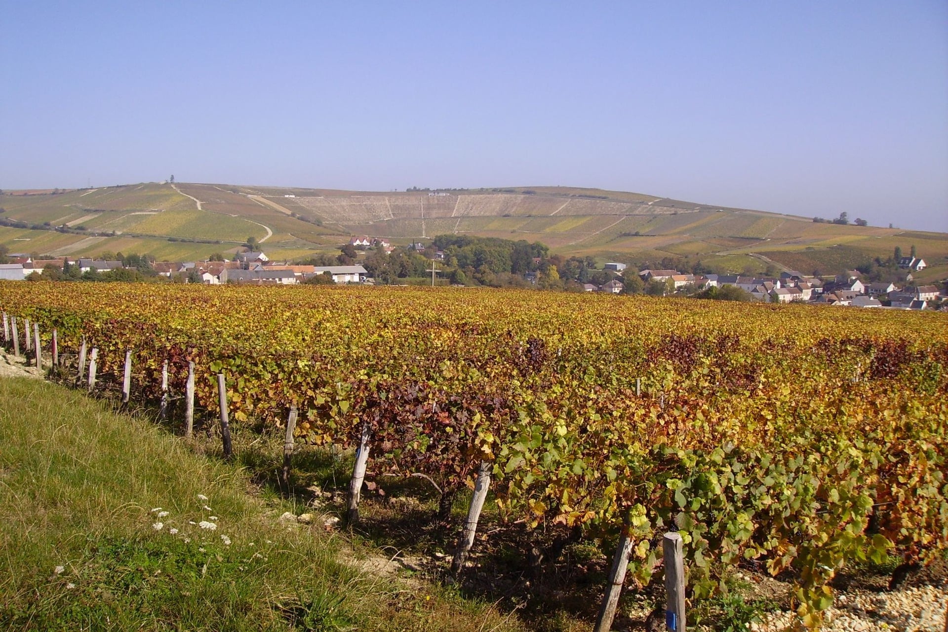
September: 23 °C, 8 rain days and quieter paths, with the grape harvest around Sancerre, Vouvray, Chinon and Saumur
October: 18 °C and 13 rain days; Chambord keeps its summer hours until 25 October
November to March: 12 °C or less, short days and winter floods on the riverside paths; Villandry's château closes from 12 to 27 November 2026
For most riders, May, June and September are the best months, with long days and fewer hot afternoons than high summer. Some riverside campsites close at the end of September, so campers should check dates before an autumn trip.
Know Before You Arrive
Trains run beside most of the river, beds are rarely far apart, and the route itself costs nothing to ride.
Getting There and Back
TGVs from Paris Montparnasse reach Tours in 51 minutes at best, and trains from Paris Austerlitz serve Orléans and Blois. From London, Eurostar carries a bike to Paris only in a box or a bag, so hiring a bike on the Loire is often simpler.
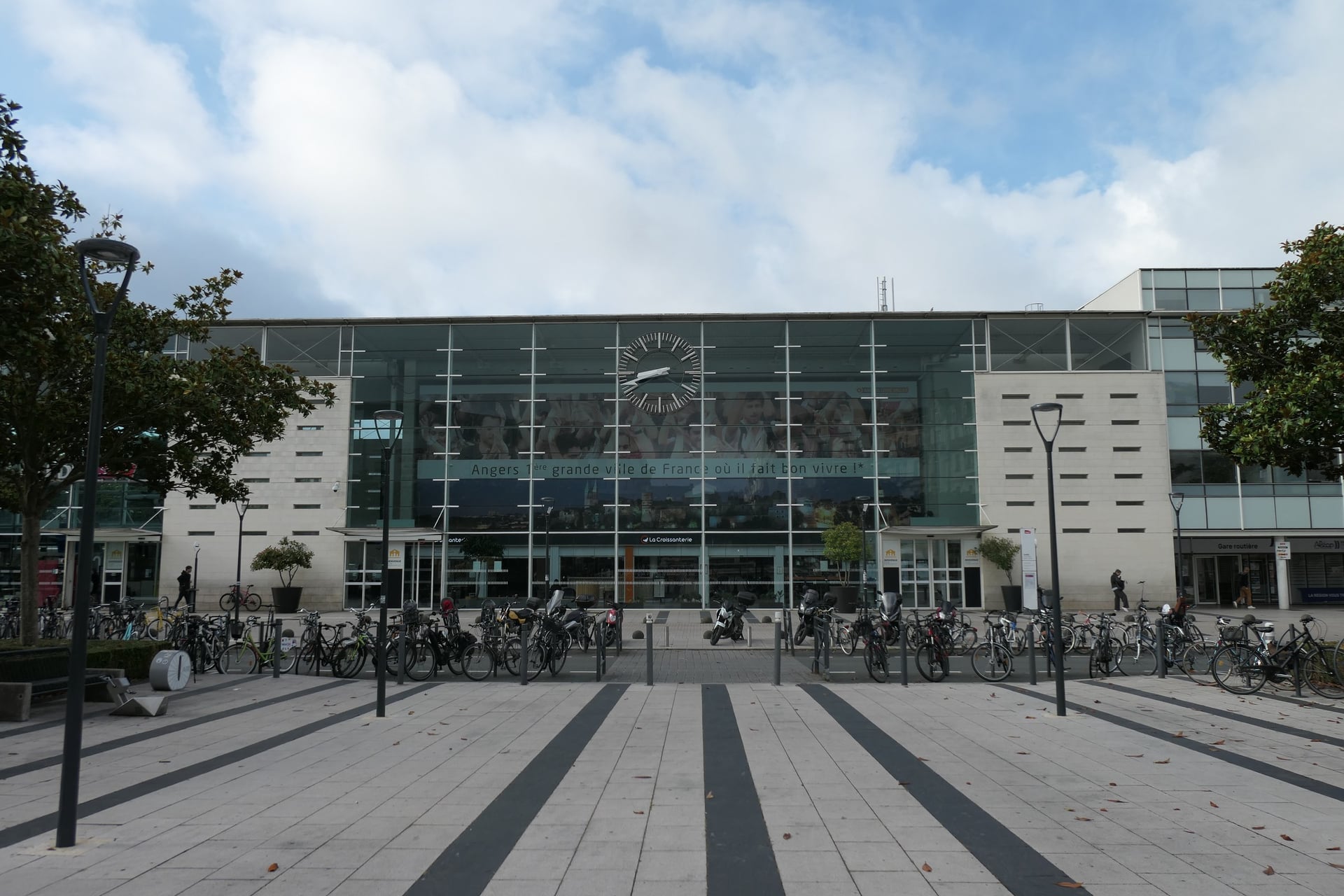
Along the river, the Train Loire à Vélo makes three return trips between Orléans and Nantes on weekdays, and two to Le Croisic at weekends. From 1 May to 27 September 2026, every bike place must be booked on veloabord.fr, separately from the train ticket.
Train Loire à Vélo stops: Orléans, Blois, Amboise, Saint-Pierre-des-Corps, Tours, Saumur, Angers, Ancenis and Nantes; tandems travel, cargo bikes do not
Other regional trains: carry standard bikes on the same lines, with fewer spaces
The upper Loire: Nevers, La Charité-sur-Loire, Cosne-sur-Loire, Briare and Gien are on the line to Paris
The Atlantic end: a shuttle crosses the Saint-Nazaire bridge from 4 July to 30 August 2026, and Aleop bus 317 carries bikes all year if booked the day before
By ferry: Portsmouth to Ouistreham, then 15 km of traffic-free path to Caen station, which has trains to Tours
By car: long-stay car parks in Nevers, Orléans, Blois, Tours, Angers and Nantes
Where to Stay
Hotels, B&Bs, gîtes and campsites line the whole valley. France Vélo Tourisme counts more than 700 with the Accueil Vélo label within 5 km of the route, and they give free, secure bike parking, luggage storage, overnight e-bike charging and a repair kit.
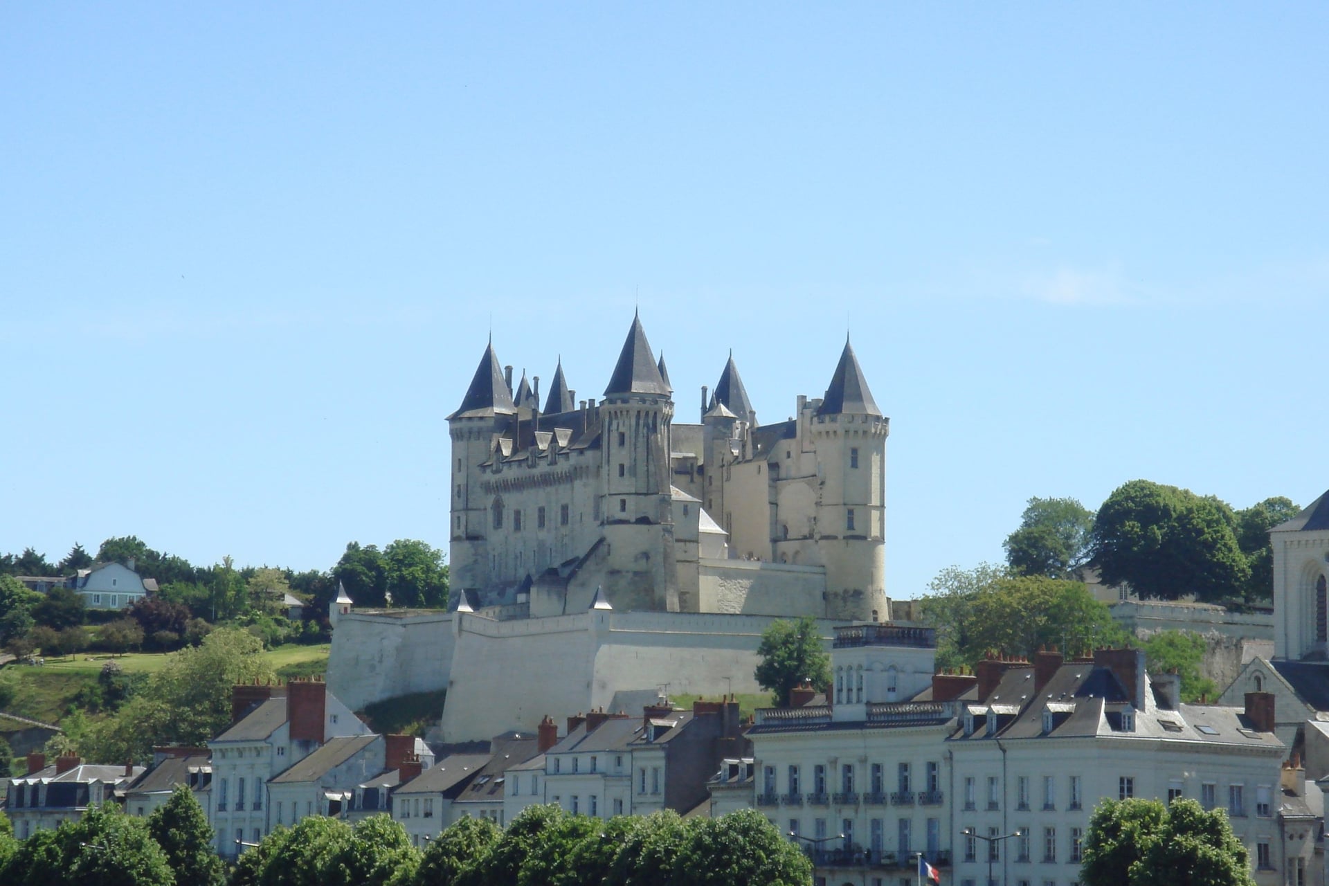
The château towns make the easiest bases. Blois works for Chambord and the Châteaux à Vélo loops, Amboise or Tours for Chenonceau, and Saumur or Montsoreau for the troglodyte villages and Fontevraud.
France Vélo Tourisme advises booking ahead in the busy areas, campsites included. Upstream of Orléans and below Nantes the villages are smaller, so book the nights on the upper Loire and the estuary first.
How Much Does It Cost?
Riding the route is free, so the money goes on beds, trains, bike hire and château tickets, which add up fastest.
Chambord: €21 for residents of the European Economic Area, €31 for other visitors (2026)
Chenonceau: €19 for an adult, with a brochure
Azay-le-Rideau: €16 from 1 April to 30 September
Ussé: €14.50 for an adult
Villandry: €14 for the château and gardens, €8 for the gardens alone
Bike hire: from €18 a day for a hybrid and €40 for an e-bike at Détours de Loire, in Orléans, Blois, Tours and Nantes
Trains: €1 for each bike booking on the Loire trains; Eurostar charges £45 each way for a boxed bike booked at least 48 hours ahead
Saint-Nazaire bridge: €5 a passenger on the shuttle, or €2.90 with a bike on bus 317
What to Pack
Tours averages 7 to 13 rain days a month from April to October, and July and August bring afternoons above 30 °C, so pack for both.
For any multi-day ride:
Waterproof jacket and a warm layer for spring and autumn mornings
Spare tubes, pump and tyre levers, as bike shops are far apart on the upper Loire
Lights and reflectors, which French law requires after dark
Two water bottles and sun cream for July and August
For La Loire à Vélo:
A good lock for château visits, where bikes stay outside
Rear panniers, which ride better than a backpack on long flat days
The GPX tracks, downloaded before you go
Riding the Château Country Without Moving Every Night
The richest corner of château country lies between Tours, Saumur and Chinon, where the Loire, the Vienne and the Indre meet. Ridden as a line, it means a new hotel almost every night and bags to repack each morning.
Riding the corner as loops from one base solves that, and so does a circuit with the luggage moved for you. Our two self-guided tours of this corner work those two ways:
Loire Valley Cycling Holidays: 6 days, with all five nights in Montsoreau. Four riding days of 20 to 75 km reach Fontevraud, Saumur, Chinon and Ussé, 190 km and 730 m of climbing in all; bike hire is extra.
France's Castles, Rivers and Vineyards: 8 days, with seven nights in five towns from Chinon. It rides 22 to 55 km a day via Fontevraud, Villandry and Azay-le-Rideau, up to 260 km in all, with a touring bike included.
Both run from April to October and include hotels with breakfast, luggage transfers, a GPS app and support while you ride. Ask us about dates for next season.
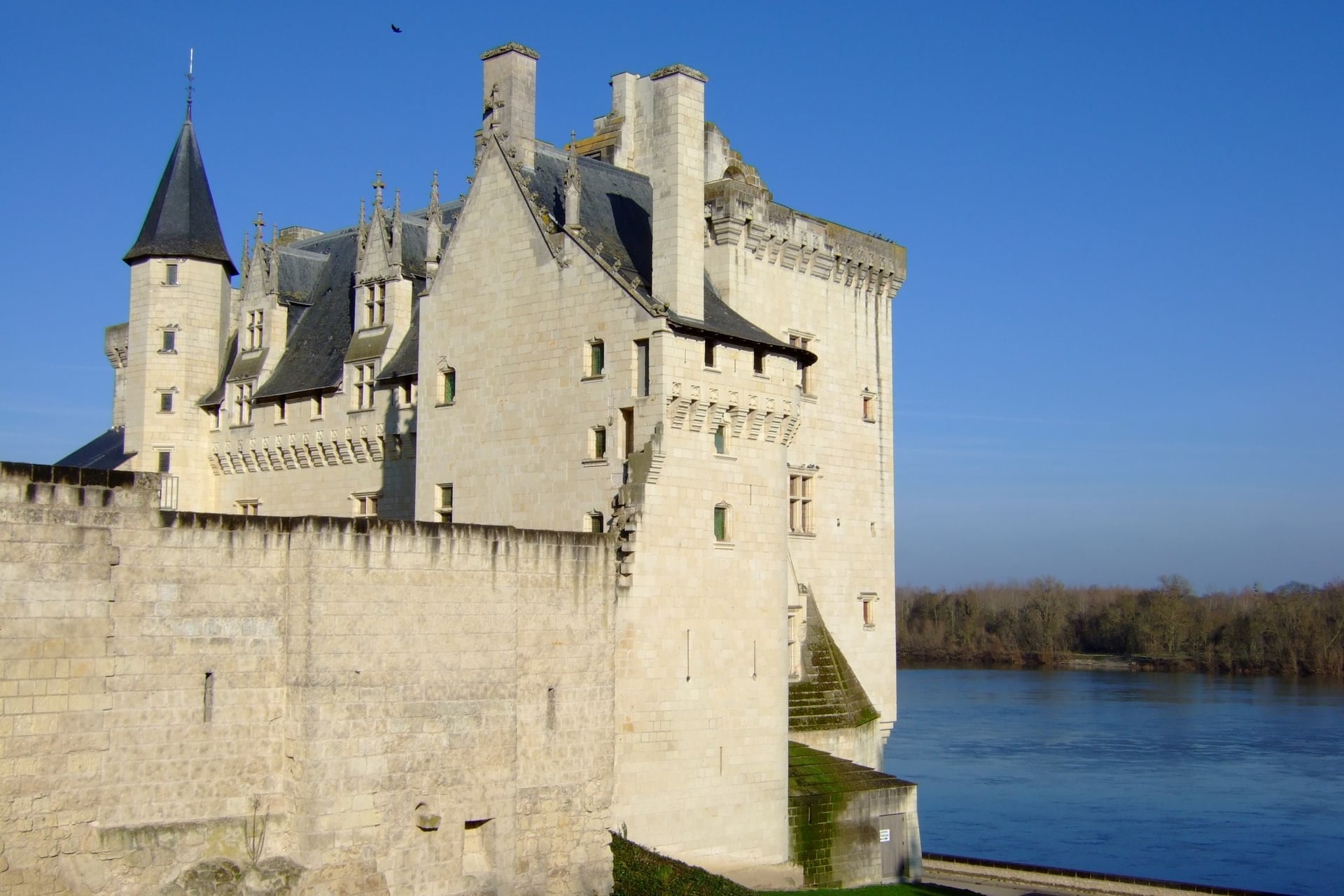
In the evening at Montsoreau, the white tufa château stands at the water's edge, and the Loire slides past its sandbanks towards Saumur, Nantes and the Atlantic.
Frequently Asked Questions



Plan with a cycling expert
Free advice from a team that knows these routes inside out - real people, not a bot

Hassle-Free
We take care of route planning, accommodations, luggage transfers, and all logistics, so you can focus purely on enjoying your ride.

Tried & Tested Adventures
Our cycling routes are hand-picked & tested, to ensure breathtaking landscapes, smooth roads, and maximum safety - giving you the perfect ride every day.

Unbeatable Support
Our 24/7 customer support is where we show our passion, ensuring your cycling holiday runs smoothly and your well-being is always our top priority.

Book with Confidence
We are a financially protected company, fully bonded and insured, keeping your money safe and allowing you to travel with confidence.